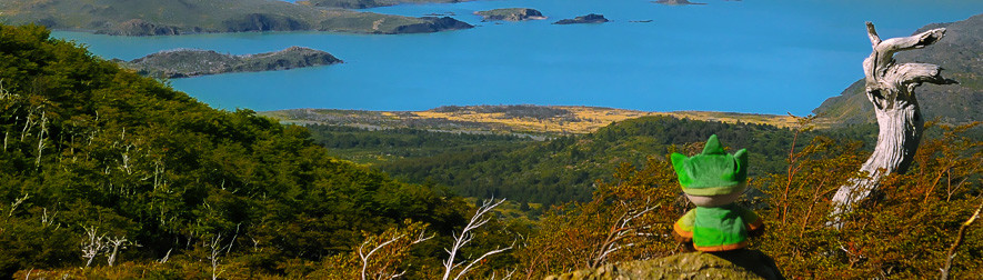
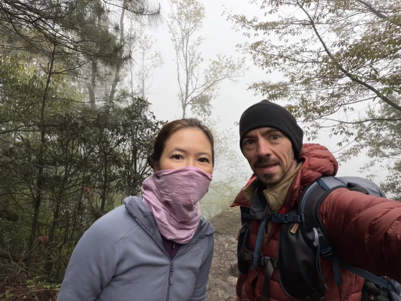
A while back I posted a preview. One frame, color graded on a phone in a freezing lodge, with a promise that the real versions were coming once we got home to actual monitors and actual software.
We’re home. They’re done. Four nights of no sleep at altitude, and here is what survived.
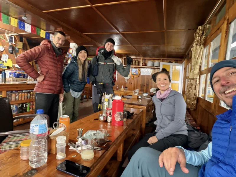
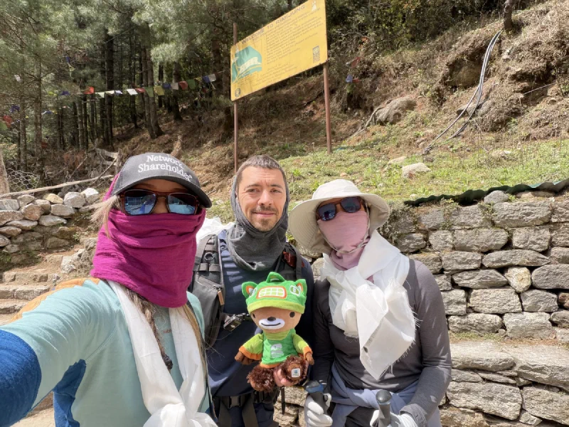
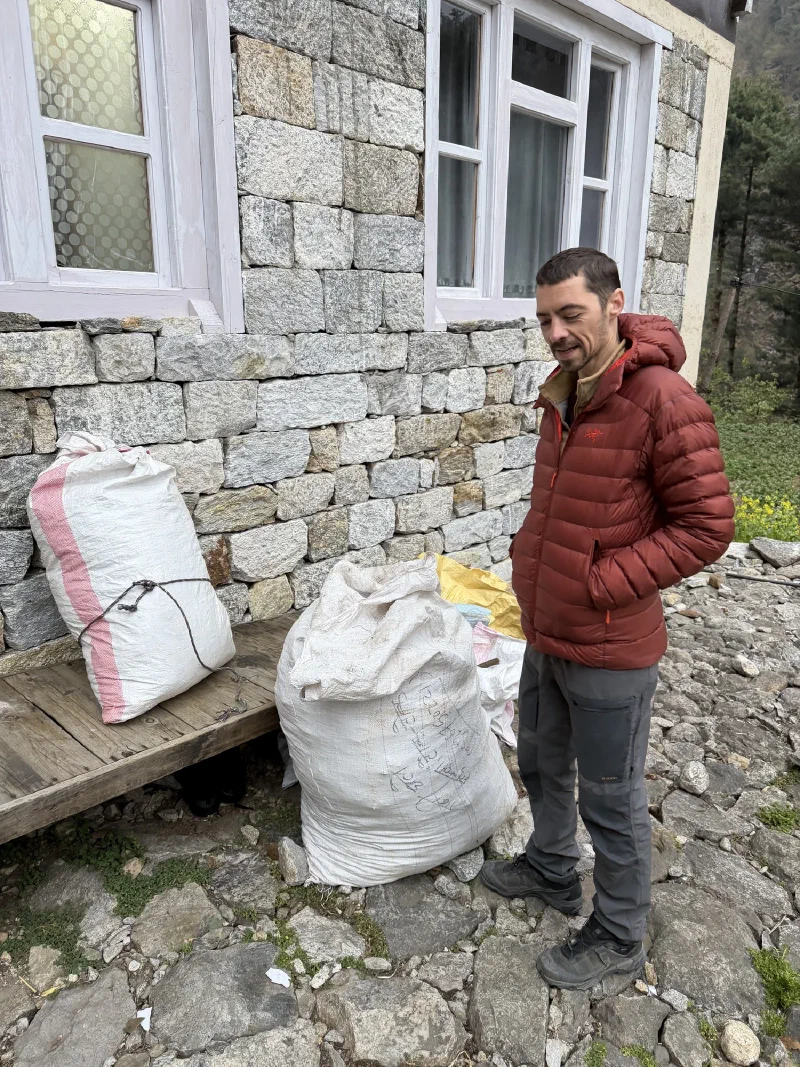
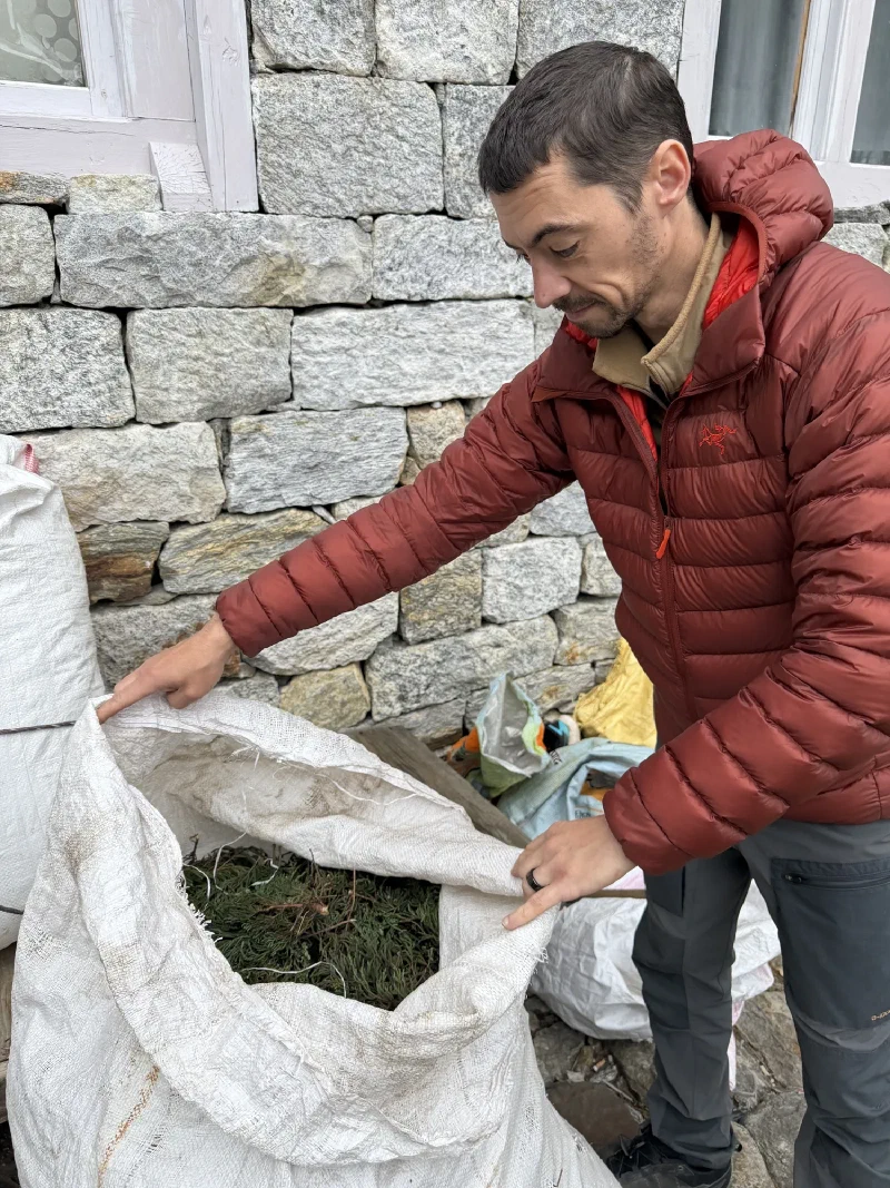
A quick reminder of what went into these, because I am not going to let it go. Four nights, Nicholas climbed out into the cold while the rest of us were sensibly unconscious and let the camera shoot the sky for hours. I supervised from inside a sleeping bag, which is the correct division of labour.
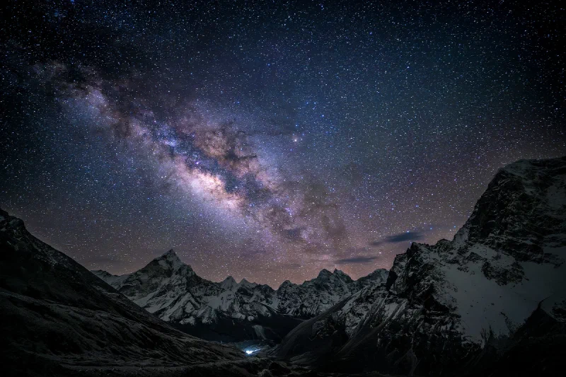
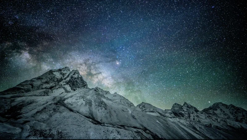
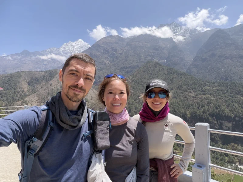
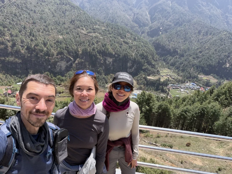
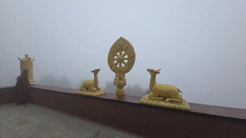
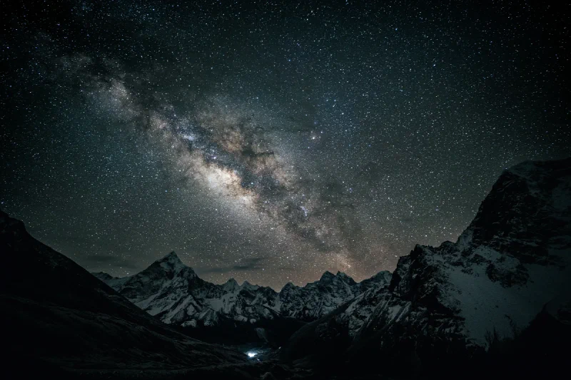
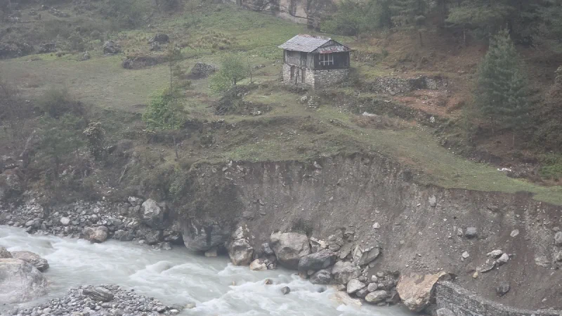
First, the Sherpa Memorial at Chukpi Lhara, near Lobuche. The one from the preview, except now it looks the way it was supposed to look. The Galactic Center over the valley, the snow peaks catching starlight, and a single cluster of lights at the bottom, which is the village of Dingboche being very far away and very small. Full story: Redemption at the Sherpa Memorial.
The Sherpa Memorial, Chukpi Lhara. The lights at the bottom are Dingboche, a long way down. This is the one the phone preview was pretending to be.
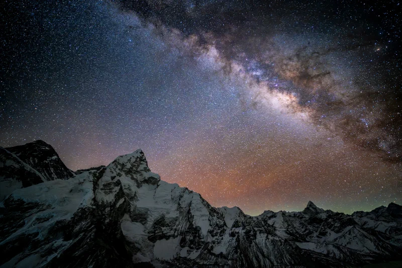
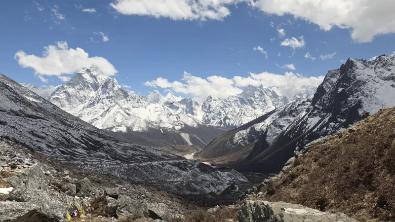
Second, Everest, from Kala Patthar at 1 AM. The highest and coldest of the bunch. No valley, no village lights, just a wall of jagged snow peaks and the most colorful sky of the set, a band of orange airglow on the horizon with a faint touch of green off to the side. The climb behind it: The Kala Patthar Speed Run, at 5,164 meters on three hours of sleep.
Everest, from Kala Patthar at 1 AM. Strongest airglow of the set, that orange band along the horizon. Worth every degree below freezing, apparently.
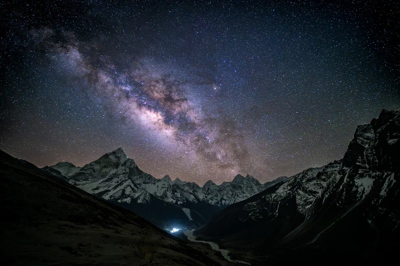
Third, Thukla, on the way back down. The hill Nicholas crossed an unfinished bridge to reach, because the sensible route did not exist yet and that was apparently not reason enough to pick a different hill. The path winds down toward more village lights, the core parked right over the central peak. The saga: Sleeping on the Mountain.
Thukla. The winding path leads your eye straight down to the lights, and the core parks itself right over the peak. He earned this one with a gorge crossing.
And then there is the one that got away. The first frame from the night framed on Ama Dablam, with a new moon and the Milky Way set to rise right behind the peak. You can see it starting. The dust band curling out from behind the mountain, green airglow along the ridge, and the Galactic Center still tucked behind that big peak on the left, about to climb into the open.
The first frame, with the core right there behind the peak, seconds from rising into the open. This is as good as this shoot got.
It never made it. A frozen lens quietly dropped its aperture a few frames in, and everything after this went pure black. Five hundred photographs of nothing, and one early frame that survived to show what it would have been. The full, gutting story is in The Astrosaster.
The stills are only half of it. The real point of standing in the cold for hours was the motion, the stars actually wheeling over the Himalayas, which does not fit in a photo. So Nicholas cut it into a short film.
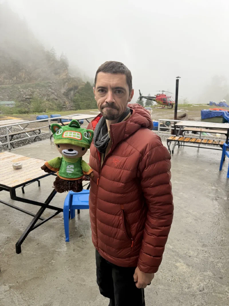
Four nights of suffering, three keepers, and one bear who stayed warm the entire time and regrets nothing.
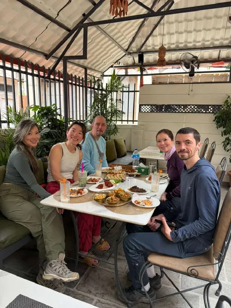
We had one last day in Kathmandu, and we had missions.
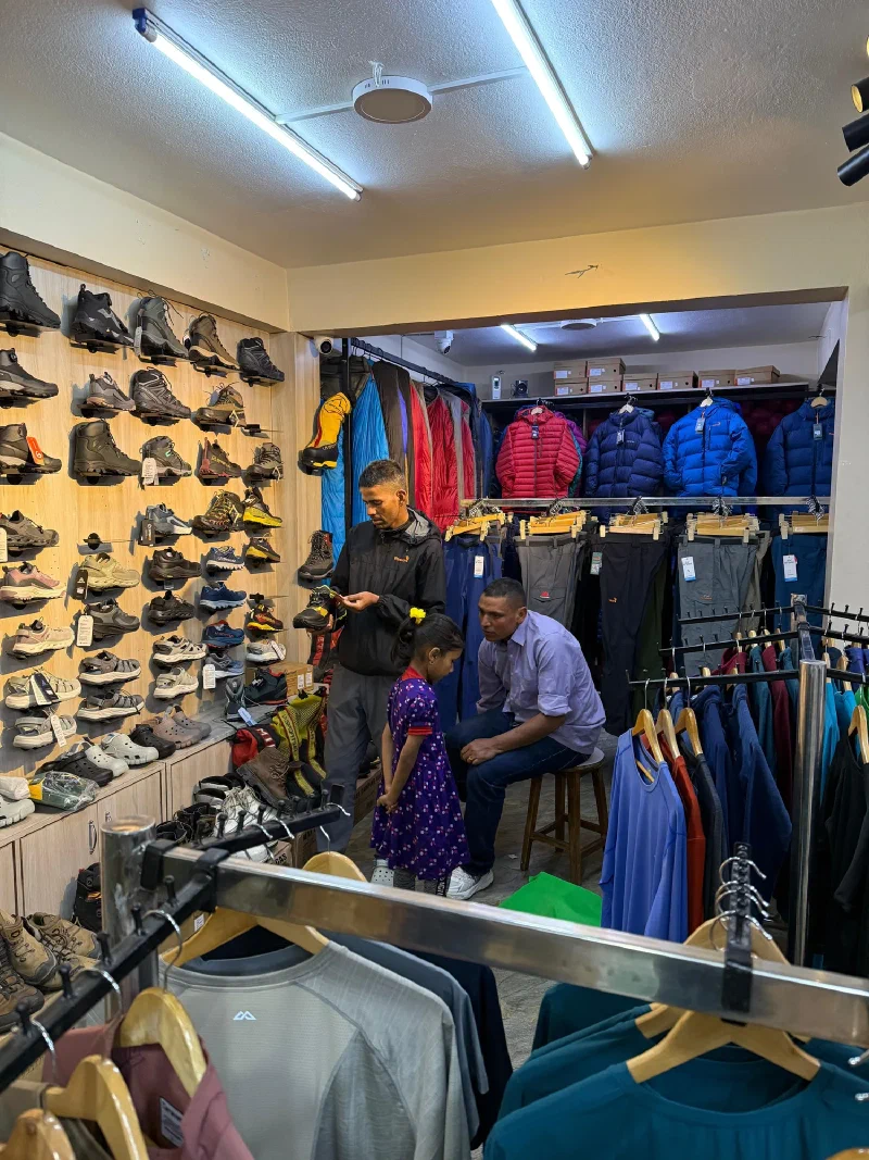
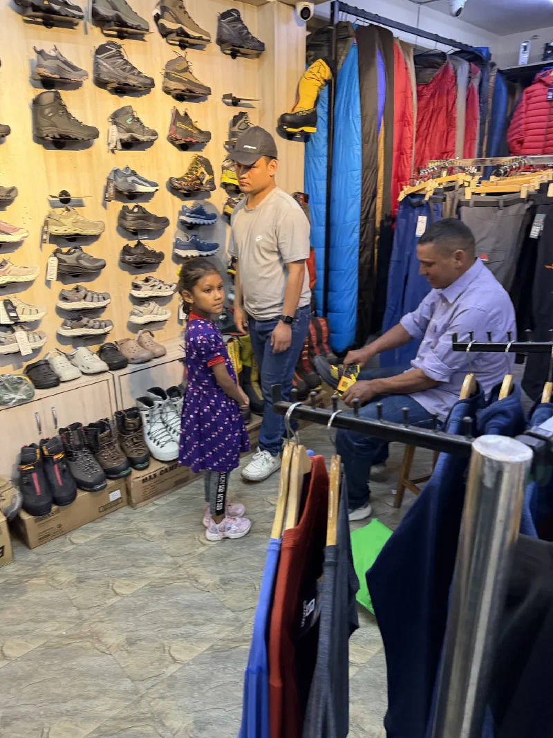
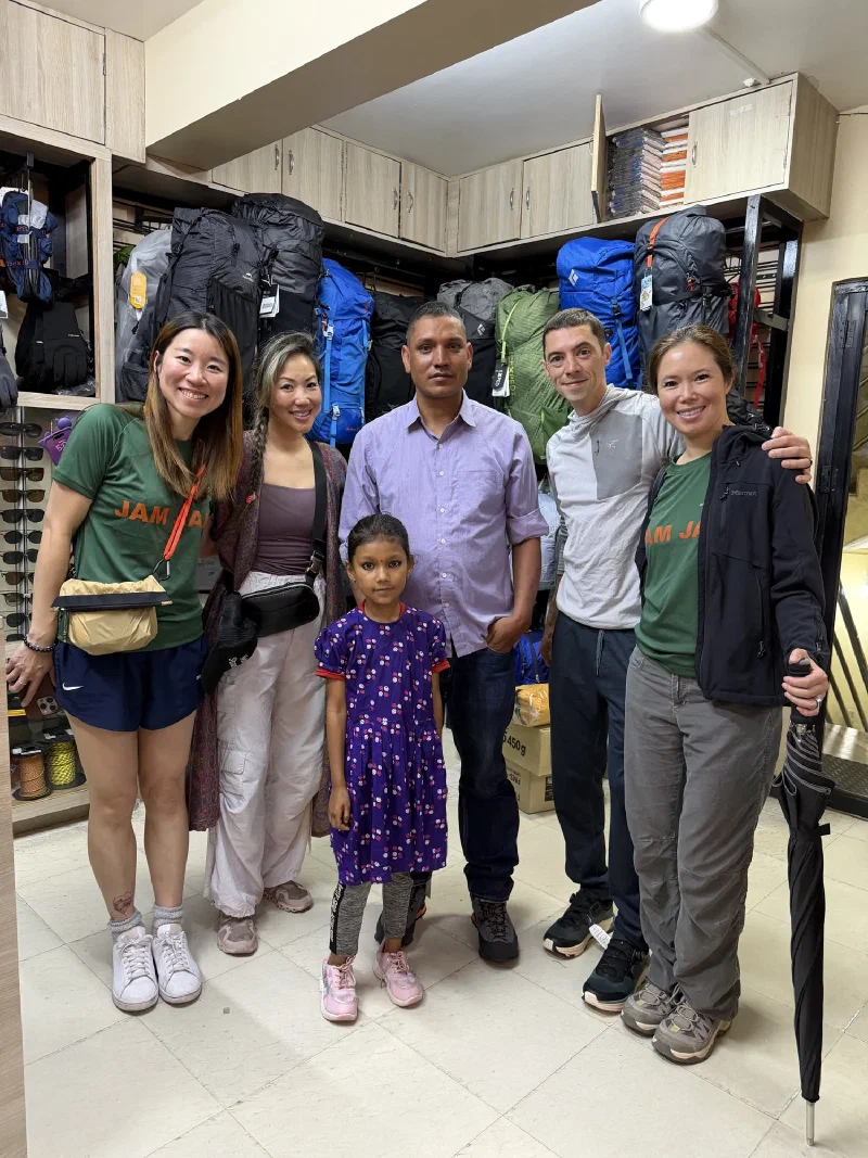
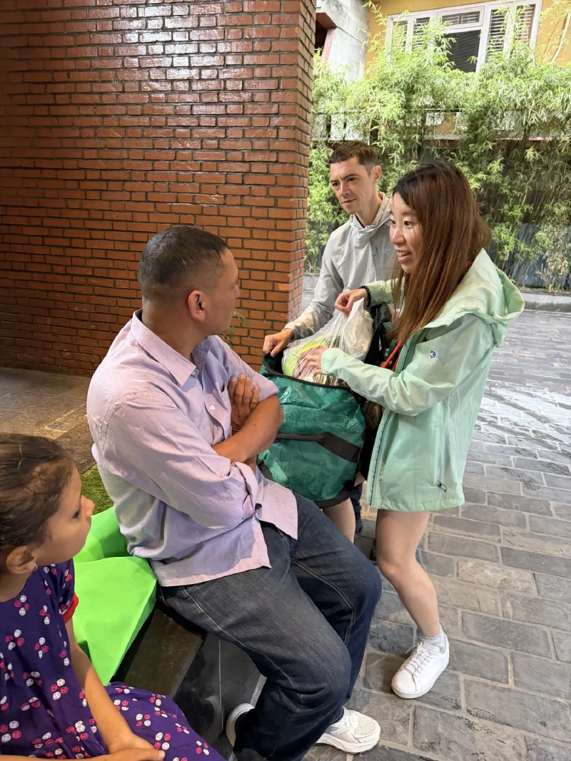
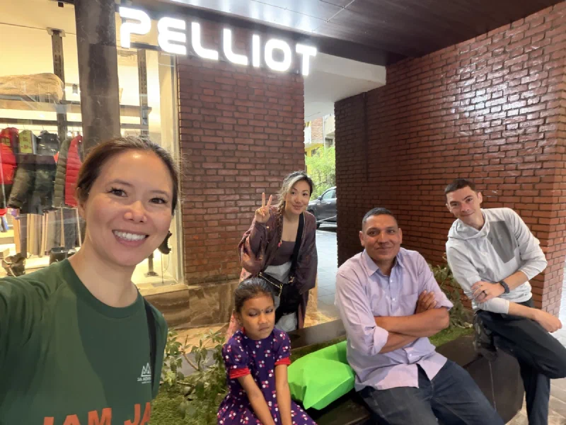
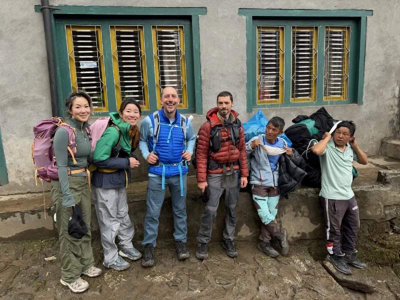
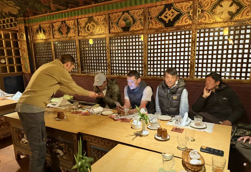
Mission one: Manoj needed shoes. The man had spent three weeks walking slowly behind Pokin over snow and ice in a pair of beat-up tennis shoes with actual holes in them, like footwear was a suggestion rather than a requirement. This was unacceptable. So we all went to a local sporting goods store to get our guide his first real pair of hiking boots.
Manoj and his daughter at the store. She came along to supervise the boot acquisition.Manoj trying on real boots. With laces and treads and everything.The whole crew, mission accomplished. Manoj’s feet have been upgraded from ‘suggestion’ to ‘actual hiking boot.’
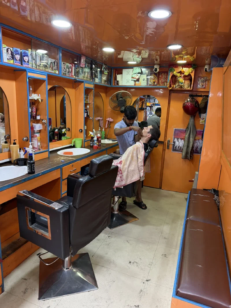
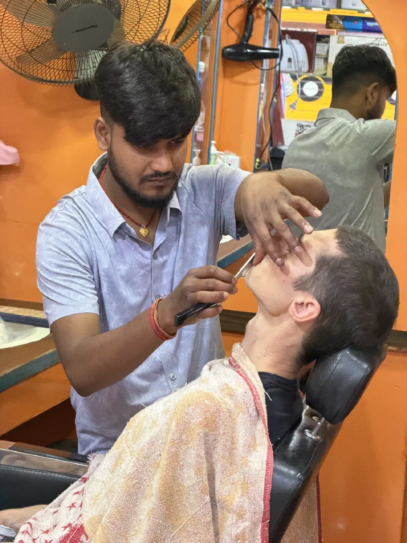
Mission two: Nicholas needed to stop looking like he lived under a bridge. Three weeks of trail had turned him properly scruffy, so he wandered into a random barbershop and asked for a shave. With a straight razor. By a man he’d met four seconds earlier.
Nicholas, in the chair, committing.A straight razor at the throat from a complete stranger. This feels irresponsible. I watched the whole thing in case I needed to be a witness.
Then we met Manoj back at the hotel for his own sendoff. He’d brought scarves and tea for everyone. No cocoa? I question his gift-giving sensibilities.
Manoj giving Po On her scarf.The whole crew, properly scarved.
Remember Alice? She’d escaped a day early on that one sketchy helicopter seat out of Surke. When she left, D.B. had handed her an extra piece of luggage to carry back for him. No big deal. Then, while we were all sitting in the airport that evening, D.B. called her. “Alice, Alice, I need you to do something for me. I need you to take the chicken out of my bag.”
The chicken. Out of the bag.
We assumed he was joking. He was not joking. There was, in fact, a bag of actual chicken in his luggage, given to him by one of the porters’ families on the way out as a parting gift. Alice had unknowingly couriered a chicken down from the mountains. So the next day she packed the chicken back up and brought it to the hotel, to hand to Manoj, to give back to D.B. A whole relay of people moving one chicken across Nepal.
Alice, returning the chicken. The most-traveled chicken in the Khumbu.
And then Manoj left. The last of our guides, off to his next group of people who had no idea what they were walking into.
Goodbye to Manoj. Good boots, this time.
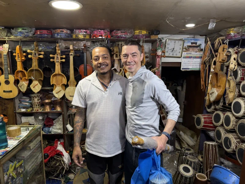
With the goodbyes done, Nicholas was free to do the thing he does in every interesting country on earth, which is hunt down weird instruments.
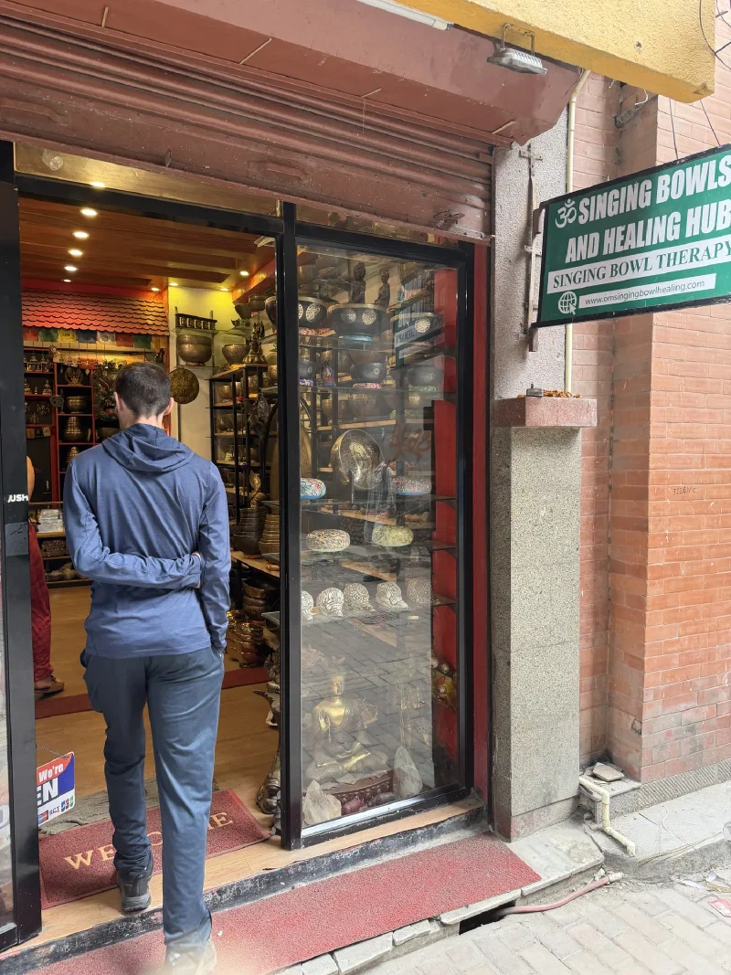
First up, singing bowls. Pokin tracked down one of the top singing bowl masters in the country, who happened to have a shop in town. We walked in and Nicholas started sampling bowls, working through them one at a time, until the master pulled out a special collection tuned to a full octave of notes. That was the end of any restraint. Sold.
Walking into the singing bowl shop. The wallet did not survive.Testing one of the big bowls back at the hotel.
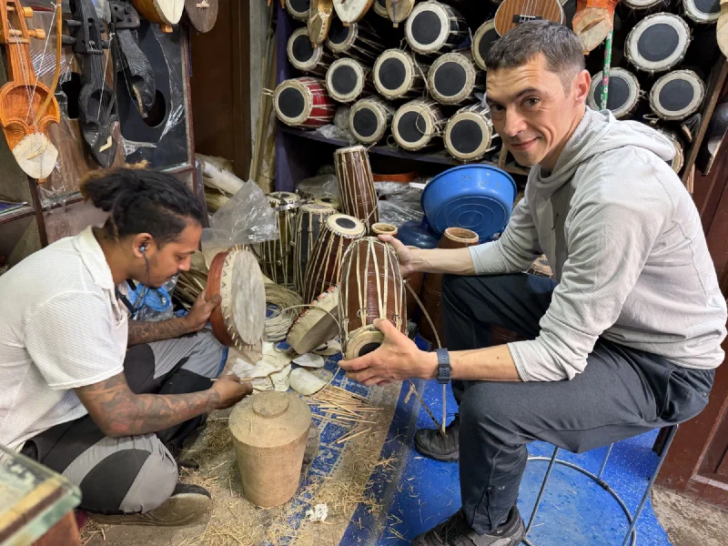
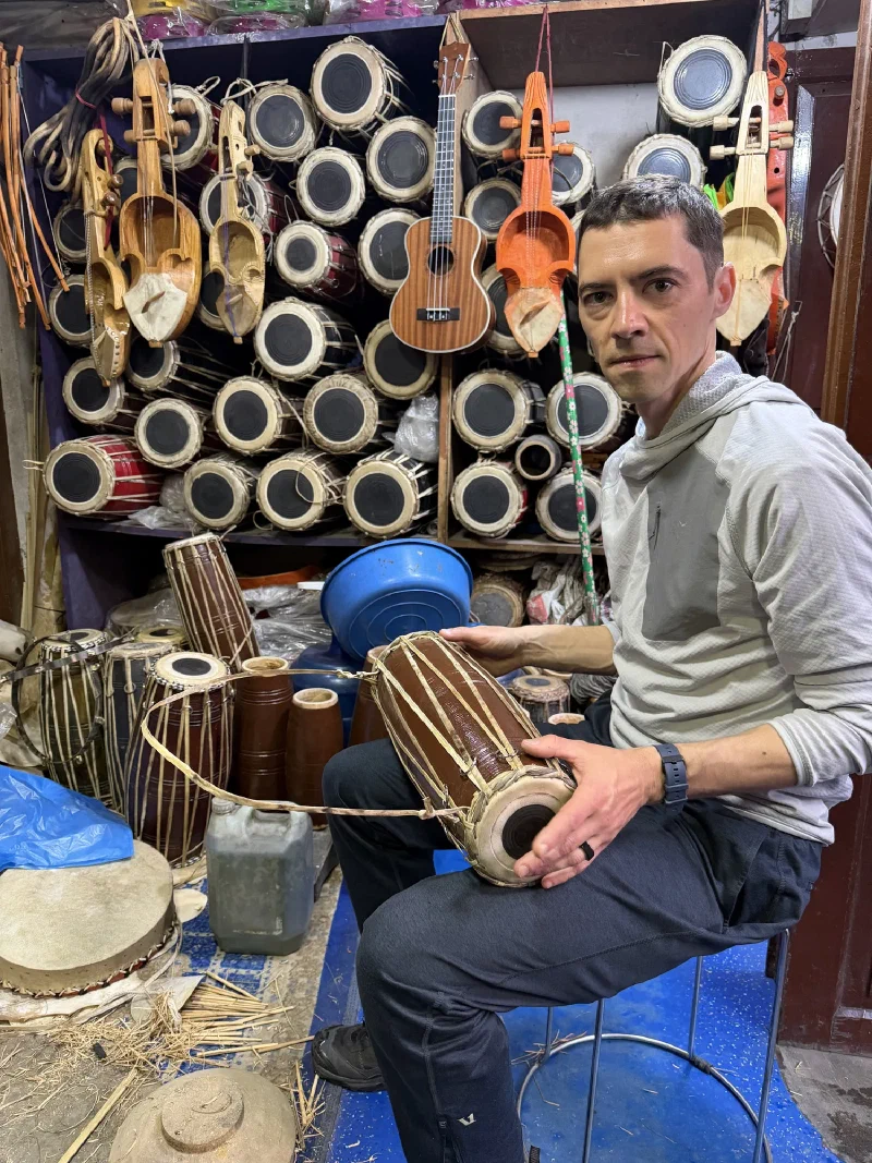
Then, walking down the street, we found a guy named Ashish sitting on the ground in a tiny shop making his own drums by hand. Of course we had to stop. Nicholas and Ashish talked for a long while, played a few together, and he showed Nicholas some beats. Then he customized one of the drums right there, cutting fresh leather for the head. Nicholas walked out with an armful of new instruments.
Ashish, mid-build, surrounded by his own work. Nicholas found his people.
At which point the obvious question became: where exactly are we going to fit all of this? A full octave of singing bowls, a pile of hand drums, and everything else we’d hauled down a mountain. We crammed it all into the bags through sheer force of will, and then it was time to go.
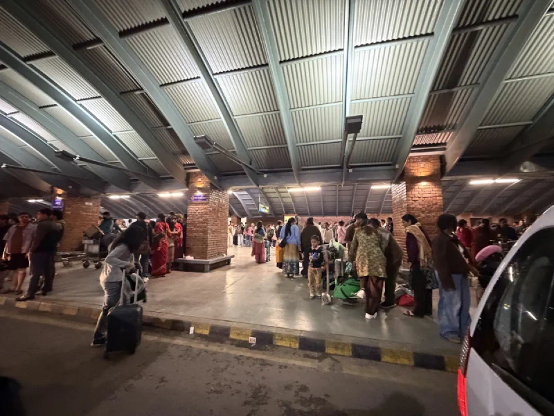
The airport. End of the line for Nepal.
Goodbye, Nepal. We had many plans, none of them went the way we planned, so we made many new plans, and that didn’t go as planned either, but we made it. I’m glad to be headed home, but knowing Pokin, I’m sure she’s already re-planning to see you again soon.
We woke up very early at Surke and braced for the worst, because the weather report had promised the worst. Then we looked outside. It was not the worst. There were still clouds everywhere, but you could see things. Mountains. Sky. The general concept of “up.” After the fog wall that had stranded us the day before, this counted as optimism.
The view out our window. Not clear. But clear-ish. Clear-ish is enough to get your hopes up.
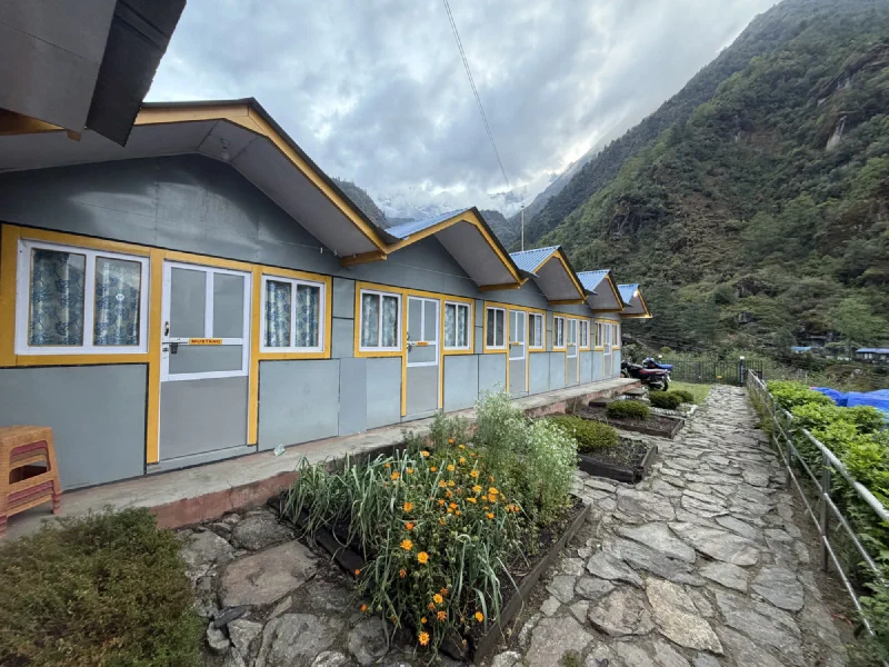
A reminder of where we’d spent the night. The “rooms” at the Surke airport were not exactly the soft-bed-and-hot-shower situation we’d been promised back in Lukla.
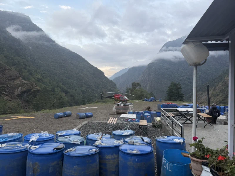
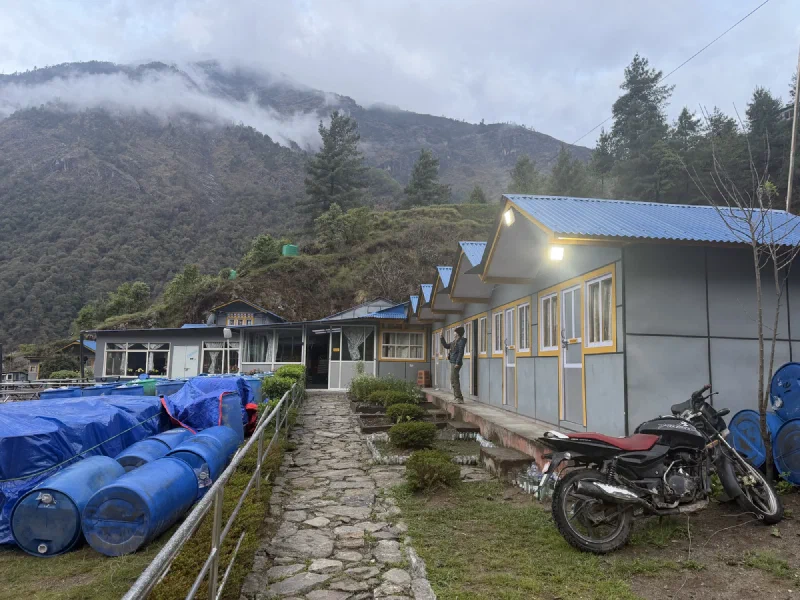
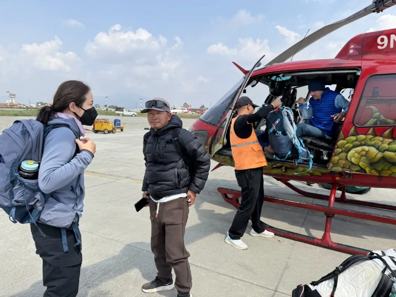
So we packed up fast, because mornings are when the clouds are highest and your odds are best. And then we spotted him. Our pilot. Already out at the helicopter, prepping it to fly. The same Fishtail Air machine, parked among the same casual barrels of gasoline strewn around the field, because nothing says aviation safety like jet fuel lying loose in the grass next to the helipad. This was it. Our ride home was warming up.
The pilot prepping the helicopter. Our helicopter, we assumed. We assumed a lot of things.
He climbed in. He started it up. And then he took off.
Without us. Without a single word. We watched our ride lift off the pad and disappear into the clouds while we stood there holding our bags like a group of people who had just been very thoroughly stood up.
Oh. Well then. Back to the lounge.
Back inside. Same chairs. Slightly less faith in helicopters than we’d had ten minutes earlier.
That is when the Sherpa explained how the morning after bad weather actually works. The clouds had been bad the day before, which meant a lot of people higher up the mountain never got their flights. So the morning after, every helicopter commits its schedule to rescues. They start at the top, where the clouds clear first, and they work their way down as the fog lifts, grabbing the stranded people in order of altitude. We were not up high. We were at the bottom of the list. Our pilot hadn’t abandoned us out of spite. He’d just gone to collect people with a better claim on him than us.
So the plan became: wait, and hope somebody, anybody, swings low enough to scoop us up before the clouds came back down and closed the whole valley for the day.
We settled the bill for our luxury accommodations.
The bill for the night. You pay for the plywood. You pay for the food. You do not get a refund for the helicopter that left without you.
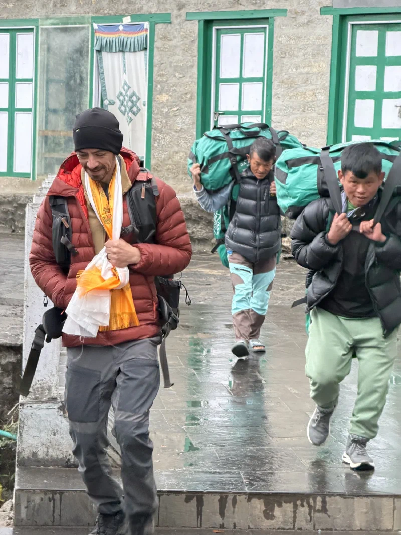
Nicholas hauled the bags back outside.
And then we did the thing trekkers do best by this point in the trip. We stood around outside and waited for the sky to make a decision.
The whole crew, waiting for a helicopter that may or may not have existed.
The fog got thicker. Nicholas started doing the grim math and landed on “we are staying another night.” A reasonable conclusion. The valley was closing up.
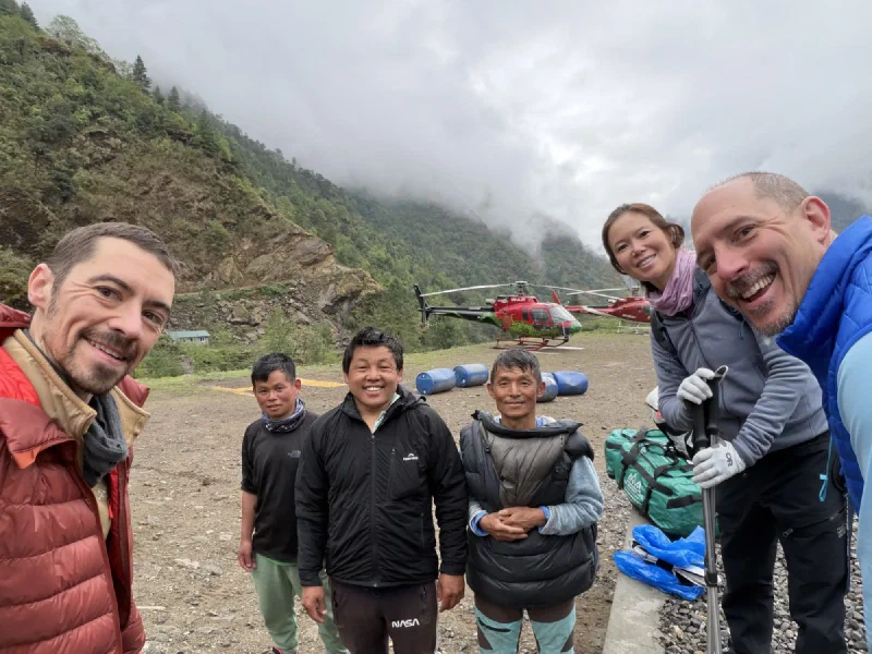
And then the same pilot came back. The one who’d ditched us at dawn. He set the helicopter down, leaned out, and said, “Okay, we’re going back to Kathmandu before it gets any worse.”
It was not the helicopter we were supposed to take. At this point I did not care which helicopter it was. We piled in.
The flight is about 45 minutes, and we spent most of it dodging clouds, the pilot trying very hard to stay VFR all the way. Then the clouds thinned, the valley opened up, and there it was. Kathmandu. Pavement. Buildings. The end of the mountain.
Wheels down in Kathmandu. Unloading the bags onto actual pavement for the first time in two weeks.Everybody alive. Everybody off the mountain. Everybody about to eat their body weight in dumplings.
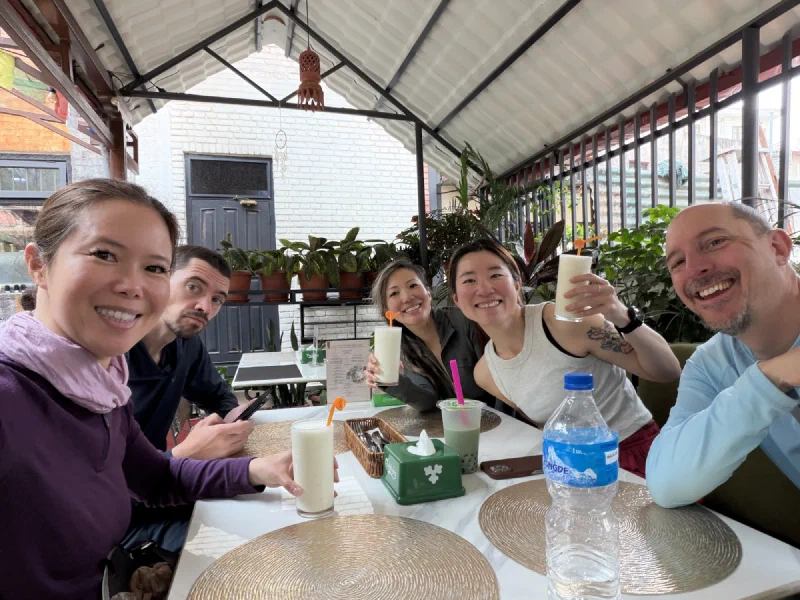
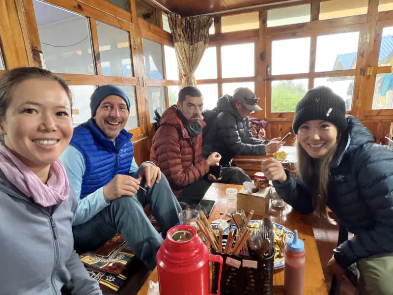
First order of business in Kathmandu: food. We reunited with Alice, who had escaped Surke a day ahead of us on that one sketchy seat and was, reassuringly, also alive. Then we found a place with a giant momo platter.
The momo headquarters.
You already know how everyone feels about momos. Pokin had been ordering them at every single stop on this trip, and now there was a nice plate of them waiting in Kathmandu. Do they make chocolate momos? No? Then I’ll wait.
The momo platter.
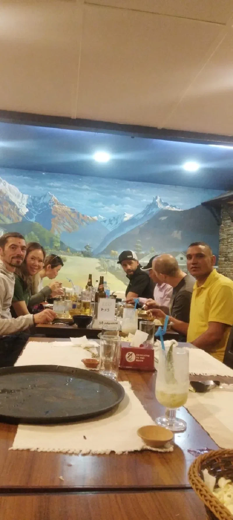
That night, D.B. and Manoj took us out for a proper sendoff. A dinner with a cultural show, Nepali dances and music performed on a stage in front of a painted mountain backdrop. The kind of “cultural experience” you have to brace yourself for.
Dinner and a show. The backdrop was a painting of the mountains, in case two weeks of the real ones hadn’t been enough.
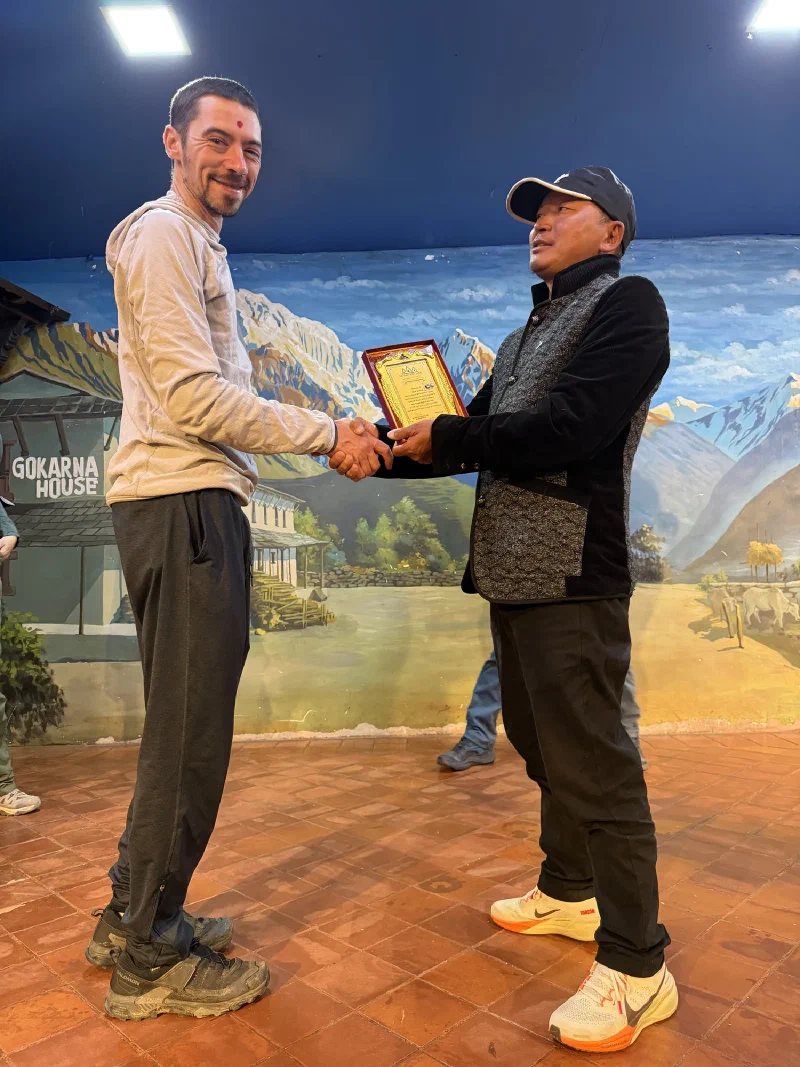
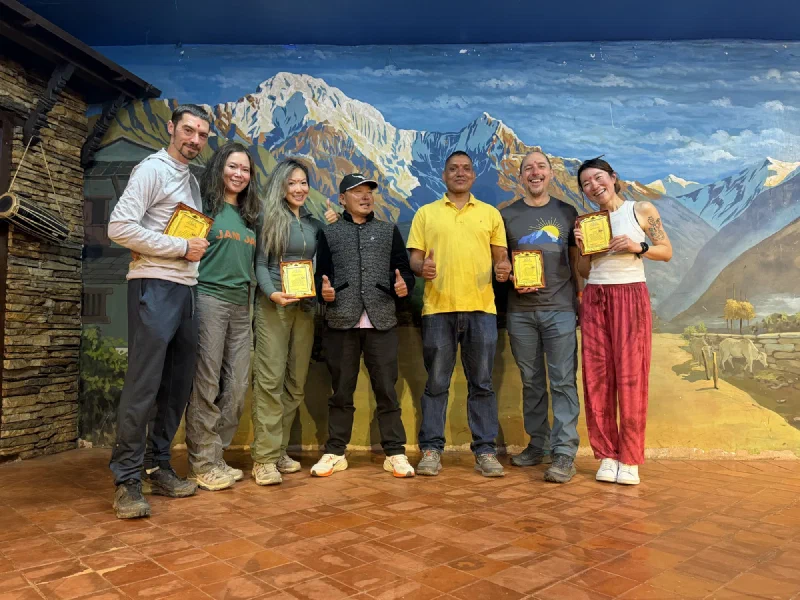
After dinner, D.B. handed out awards. Actual framed plaques, for completing the trek. Or, in some of our cases, for attempting the trek, which I think is the more honest wording given how many horses, helicopters, and hospitals were involved in our particular “completion.”
D.B. presenting Nicholas with his plaque. Tika on the forehead, certificate in hand, fully decorated for surviving.The whole crew with their hardware. We attempted a mountain. We have the paperwork to prove it.
D.B. was leaving the next morning for another trek, with another group of people who had no idea what they were in for. We had one final day in Kathmandu before we headed to the airport ourselves.
We’d made it off the mountain. Barely, and not on the helicopter we planned, but off.
The trek was officially behind us. We’d said the goodbyes, handed out the red envelopes, eaten the farewell dinner under the golden dragon ceiling. All that was left was the easy part. Pack up, walk over to the Lukla airport, climb into our helicopter, and float back to Kathmandu in time for a hot shower and a soft bed. After two weeks on the mountain, we had earned the lazy exit.
Then we woke up and looked outside. Rain.
Here is the thing nobody tells you about flying in the Himalayas. The helicopters and the little planes can only fly VFR. That stands for Visual Flight Rules, which is exactly what it sounds like. The pilot flies by looking out the window. No flying through clouds, no trusting the instruments to thread you between two mountains you cannot see. If it is socked in, you do not go. And I can fly, so I am allowed to be smug about knowing this.
So a rainy morning at Lukla is not a delay. It is a maybe.
Walking to the airport in the rain. Already a bad sign, and we hadn’t even gotten there yet.
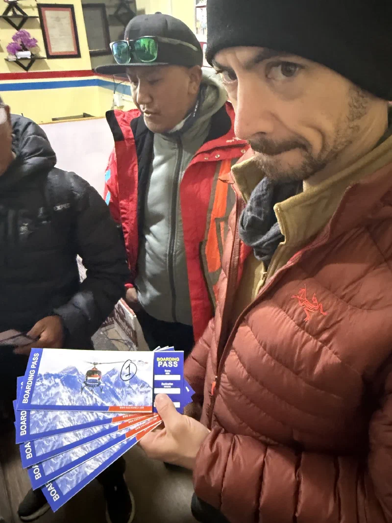
We went anyway, because the airport tells you to come anyway. They handed Nicholas a fan of boarding passes for a helicopter that was not there and might never be.
Nicholas holding tickets for a flight that did not exist yet. He is doing the face. You know the face.
Just wait a little, the airport said. The sun might come out. The helicopters might make it up. We looked out the window. The sky was getting foggier, not clearer.
After about thirty minutes, D.B. explained how this actually works. The cloud layer settles down into the valley as the day goes on. Mornings are clearest. So the longer you wait at Lukla, the worse your odds get, not better. But there was a move. If we left right now and hiked straight downhill for an hour and a half, we could reach the next town, which sits low enough that the clouds were still above it. The helicopters could land there. We could still get out today.
The catch with simply waiting it out: if the weather goes bad, everyone who was supposed to fly today is stuck in Lukla too. Then tomorrow there are twice as many people fighting for the same flights. A few bad days in a row and you get a genuine traffic jam of trekkers with no way down. There is always walking, of course. That only takes about two weeks. Or you can take a jeep from the next town, which is two days across the kind of washed-out dirt roads that are somehow less safe than flying through clouds.
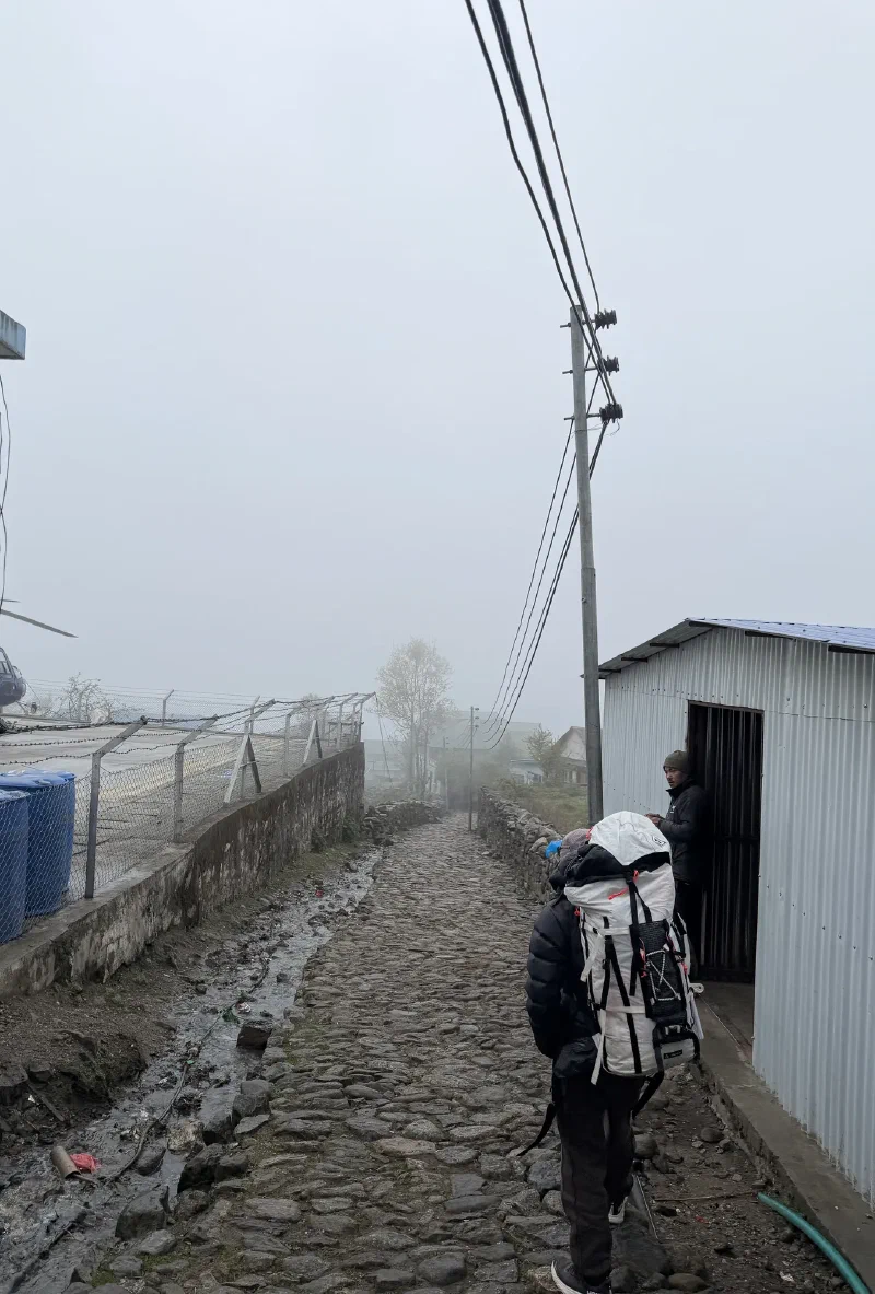
So we made the call. Book it downhill on foot and try to beat the weather to the next helipad. A race against the sky.
D.B. leading us past the Lukla airport and down the trail to Surke. The opposite direction from the one we wanted to be going.
Nicholas and Pokin did not look convinced that the weather was going to be any better down the hill. Pokin especially, who was still sick and now hiking again instead of sitting on a helicopter like a normal recovering person.
Two people doing the math on whether this gamble was smarter than just waiting. The masked one had bronchitis and a strong opinion.
The skies did not improve. They committed to the bit.
Halfway down, the crew stopped at a trail hut to regroup and practice looking optimistic. Po On, Alice, Steve, Nicholas, and the guides, all wearing the specific expression of people who have decided that smiling at the weather might help.
Optimism, performed. The sky did not care.
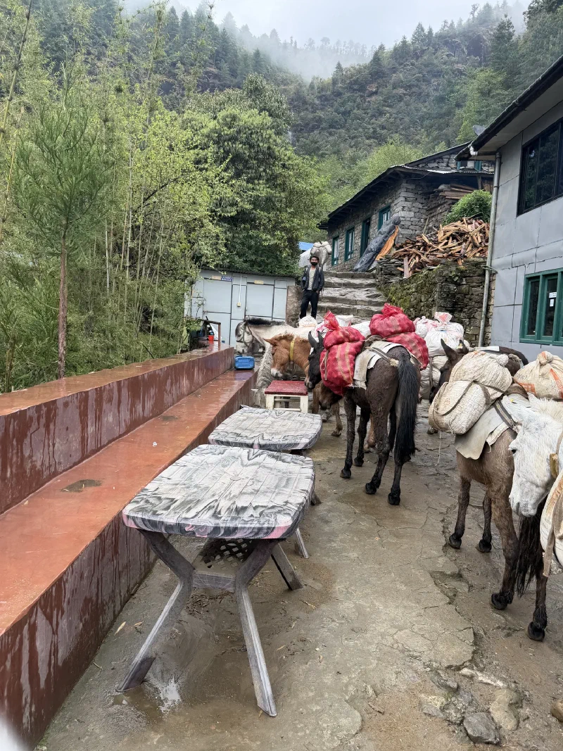
We passed loaded pack mules and the trail got properly rugged. This was not the gentle victory-lap descent anyone had pictured.
Then Surke came into view, a village with a half-built monastery on the hill above it. Somewhere down there was the helipad that was going to save us. In theory.
Coming into Surke. The monastery on the hill is still under construction, which felt appropriately on-theme for a day that was also not finished.
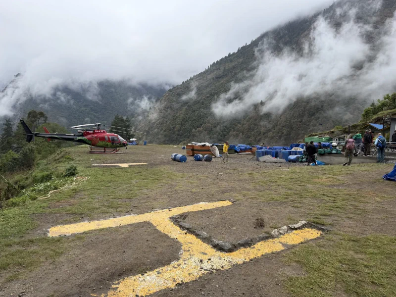
We got to the airport. I use the word loosely. It is a couple of helipads, a little terminal-slash-restaurant run by a Sherpa, and a whole lot of weather. Two helicopters were on the pad when we arrived. One of them lifted off almost immediately, empty, bolting for the valley before the clouds dropped any further and taking none of us with it. The clouds were not above us anymore. They were around us. There was no version of this that counted as VFR.
The Surke ‘airport.’ A painted H, the second helicopter still on the deck, and clouds everywhere. The first one had already bolted, empty. Not encouraging.
The porters peeled off here too. We’d already given them the proper send-off back in Lukla, dinner and tips and cookies, so this was just the practical goodbye. They were catching jeeps home from Surke, and they were not about to stand around in the fog waiting on our flight that clearly was not coming.
The last wave-off, clouds photobombing. The real thank-you happened the night before. This was just where the trail and the porters actually parted ways.
Here is where it got interesting. That second helicopter, the one still sitting on the pad, was not ours either. Ours, like most of the others, had tried to come up and been forced to turn back. But this pilot was about to make his own run for it, ducking out under the clouds toward Kathmandu before things got worse. He had room for exactly one more passenger.
That seat had originally been D.B.’s. With the rest of us grounded, he offered it up. Alice took it.
And off Alice went, alone, into a sky that was, in my professional aviation opinion, absolutely not fit for flying. The pilot swore it was clear down low and he had a line of sight out. Maybe. I am a bear who can fly under my own power, and I would not have braved that. But Alice has more nerve than sense, which I respect, and she made it.
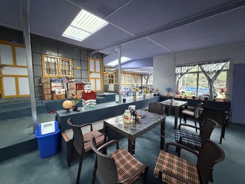
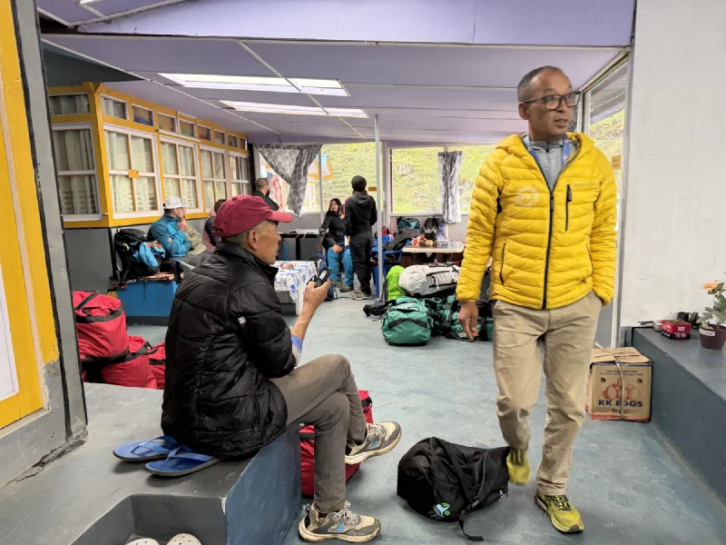
The rest of us went inside to wait. The man running the terminal, a Sherpa who clearly does this every season, promised the sun would burn off the fog and our helicopter would land in just a little bit.
The Sherpa who runs the whole operation. He had seen this weather a hundred times and was very calm about it. We were not.
It did not.
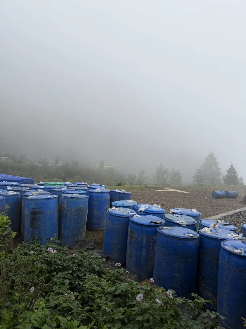
The view out the window, on repeat, all day. Blue barrels. No helicopter. Fog doing fog things.
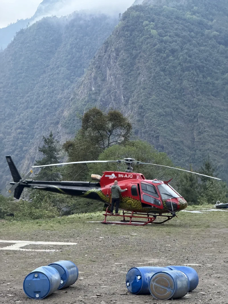
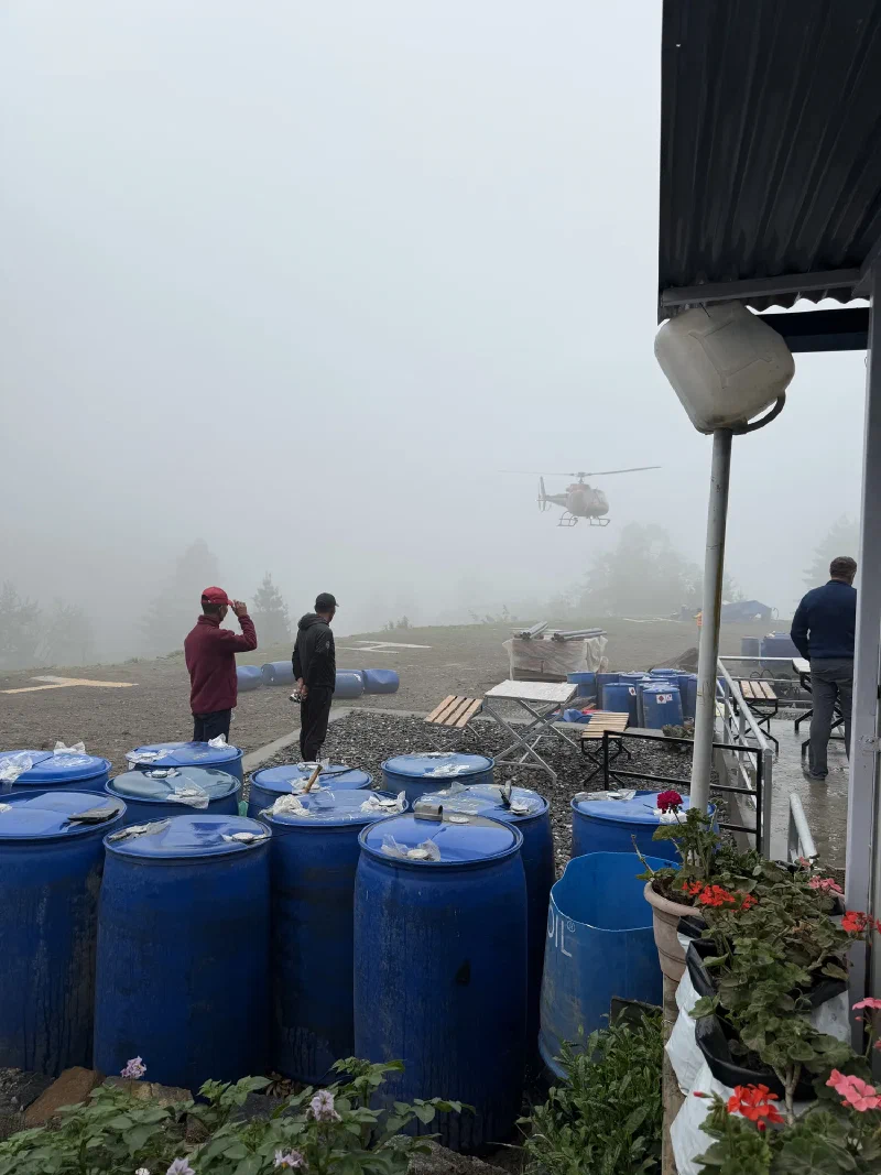
We got drinks. We got lunch. We kept looking outside. At one point we heard a helicopter, which we should not have, and a Fishtail chopper somehow came down out of the murk and landed. Not ours. He dropped some people off, took one look at the sky toward Lukla, and parked. Too foggy to climb back up. D.B. immediately booked him to take us out instead the moment things cleared.
The Fishtail materializing out of nothing. Look at that visibility and tell me that is Visual Flight Rules. I rest my case.
Spoiler: things did not clear.
Our buddy Sven from the trail turned up too, also bumped from a canceled flight, also stuck, on his way to attempt the two-day jeep escape. He stopped in to say hello to the rest of the grounded.
Sven, reunited with us under the worst possible circumstances. Misery does love company.
So we sat. And sat. The fog whited out the windows. Nicholas stopped pretending to be cheerful about it.
The crew, several hours into the wait. Nicholas has fully given up on the optimistic face.
There is a hard cutoff. Around three in the afternoon, the last flight has to leave with enough daylight to reach Kathmandu safely. By then the fog had only thickened. The pilot of the parked helicopter made the call: he was camping at the airport overnight and trying again in the morning.
Last call. Me and Nicholas and the helicopter that was going precisely nowhere. You can see the fog. There was a lot of fog.
So that was that. We could hike three hours back up to Lukla to try our luck there in the morning, except that is three hours uphill and Pokin was in no condition for it. The weather down here was the better bet anyway, even if the forecast for the next few days looked, in the technical meteorological term, grim. Our porters had already left with the jeeps, so we had no way to move the bags even if we wanted to.
Which left the Surke airport’s accommodation. Two beds in a box. The most basic rooms I have ever lowered my standards into.
Looks like we were camping a little longer than planned.
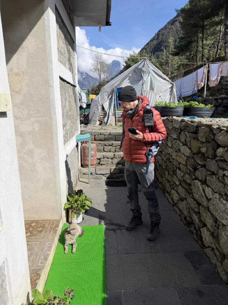
On the way in, Nicholas and Pokin never actually saw the town. They were sick, we took a helicopter straight to Phakding, and Lukla went by as a blur of “please let the rotors keep spinning.” So today we wandered. Properly. Up and down the back alleys, no duffel bags, no agenda.
Nicholas found a cat sunbathing on a mat and immediately entered a standoff with it. The cat won by not caring.
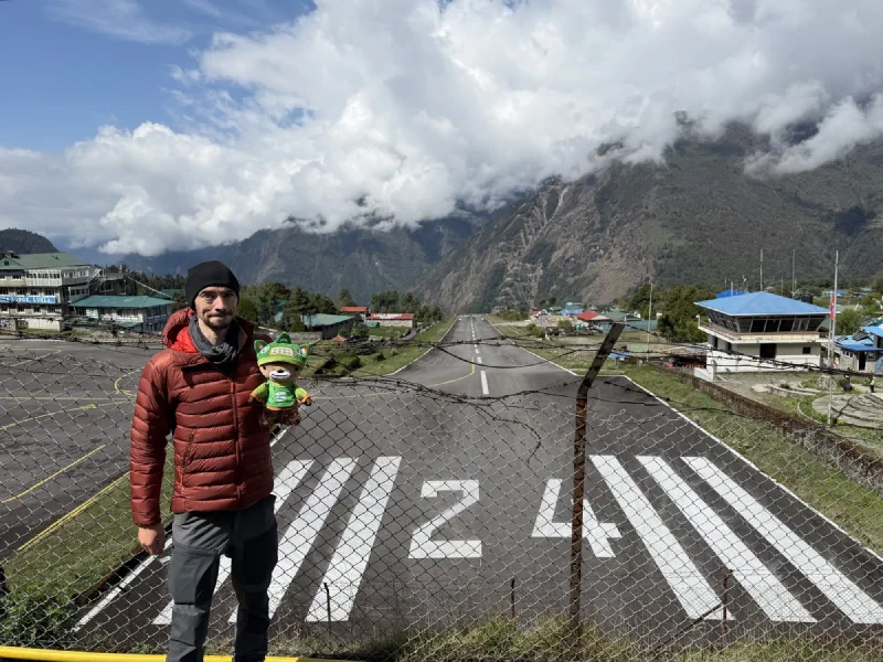
Lukla Airport has a reputation. Short runway, hard slope, a cliff at one end and a mountain at the other, and a habit of showing up on every “scariest airports” list ever written. We went and watched a few planes land on it, which is a deeply strange thing to do for fun.
Runway 24. It points downhill at a cliff. This is considered normal here.
Good news for me: we’re flying out by helicopter tomorrow, not by one of those. Apparently a helicopter is the safer option here, which tells you everything you need to know about the planes.
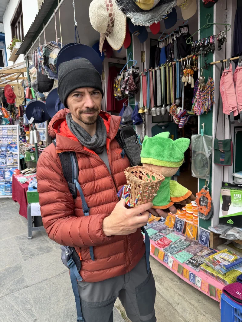
We did some shopping around town, and this is where it got serious. Someone had woven one of the traditional head-baskets, a doko, in a size that was suspiciously, perfectly, me-sized.
Nicholas held it up to my back to check the fit. It fit. There was no further discussion. It came home with us.
Naturally we had to get it. I am a bear of refined taste and I now own a tiny artisanal Himalayan basket. I have no plans to ever carry anything in it. That is not the point.
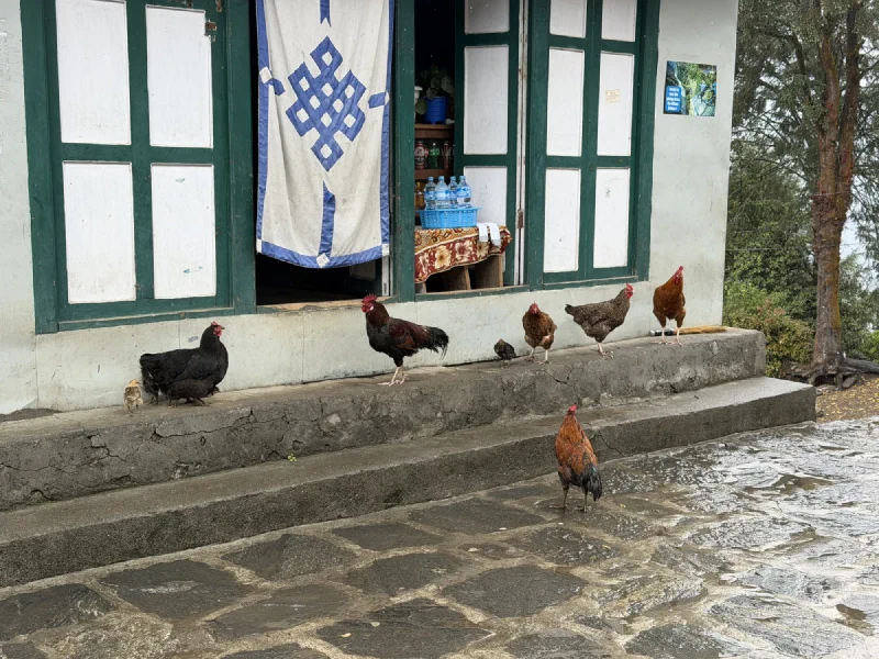
We also passed a bunch of chickens and a pile of tiny chicks, which was more interesting than it sounds. Lukla is about as high as chickens go. Any higher and they don’t make it, so all the chickens on the trek live down here at the bottom. The whole way up the mountain, no chickens. Come back down, and suddenly poultry everywhere. Nature has opinions about altitude.
Then it was time for the real reason today mattered. The farewell dinner for the crew.
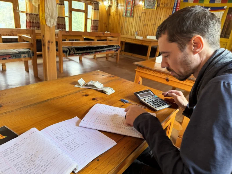
These porters hauled our gear up and down a mountain for three weeks. Our duffel bags, the food, the boxes of fruit, all of it, on their backs and headstraps, while we struggled to carry ourselves. Tonight was the thank-you.
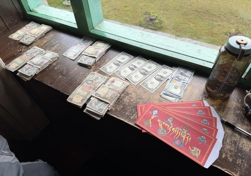
The tips. Cash, stacked, ready to load into lucky red envelopes.
Nicholas spent a good chunk of the afternoon counting out tip money into red pockets. There were stacks of rupees and dollars laid out on the windowsill, and at one point he looked less like an engineer on vacation and more like a small-time crime boss doing his books.
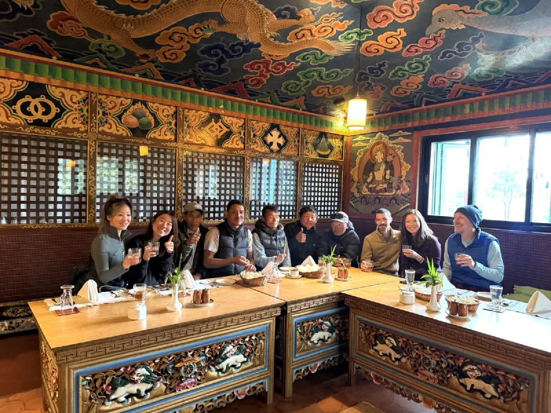
The whole crew, under a golden dragon ceiling. Three weeks of work, one very good dinner.
We brought treats too. A friend of ours owns a cookie company, so we’d hauled a stash of her cookies all the way to Nepal, and the porters got plenty. They seemed genuinely pleased about it, which is the highest praise a cookie can earn from people who carry sixty kilograms uphill for a living.
Cookie distribution. A success on all fronts.
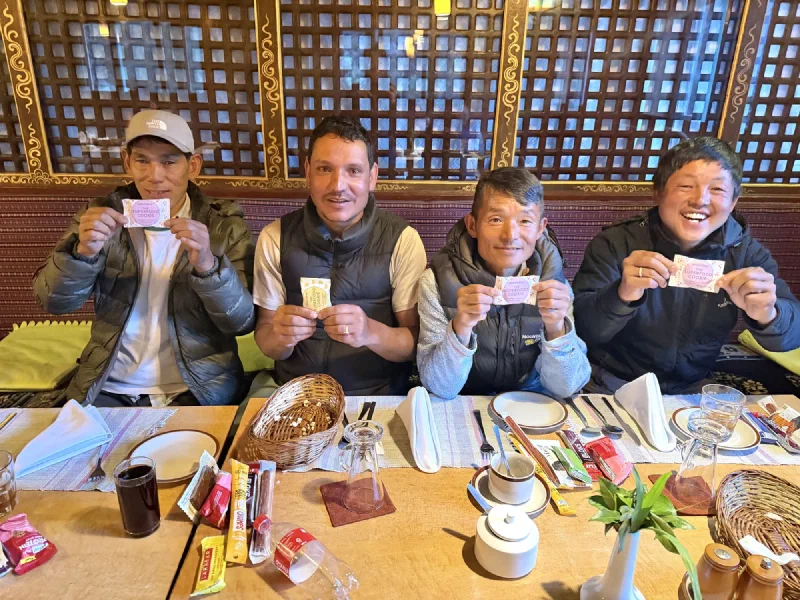
And then the part they’d actually earned: the red envelopes.
The handoff. Cookies are nice. This was the real thank-you.
It was a good night. Everyone fed, everyone tipped, everyone in one piece after three weeks of mountain.
Tomorrow morning, the helicopter back to Kathmandu. The trek part was officially behind us.
So I did what any reasonable bear does at the end of a long expedition. I claimed the best bed in the room and went to sleep.
The plan was simple. Hike from Phakding back up to Lukla, get there early, and have a buffer day before Steve and Alice rolled in. We didn’t want to be cutting it close on the last leg, so an early start it was.
One problem. Nicholas and Po On were finally, fully better. Pokin was not. She’d been the one who couldn’t shake it, and she still sounded terrible. Some people just don’t recover at altitude, and she was firmly in that camp.
Nicholas settling the final bill. Pages and pages of veg fry pasta. I have seen the ledger. It was mostly noodles.
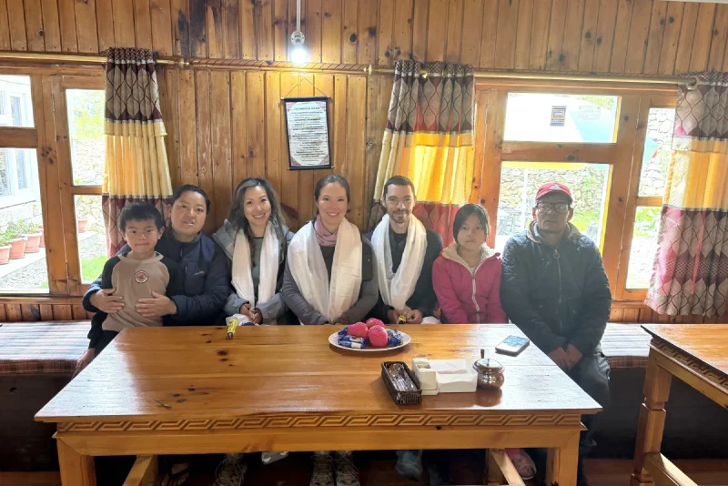
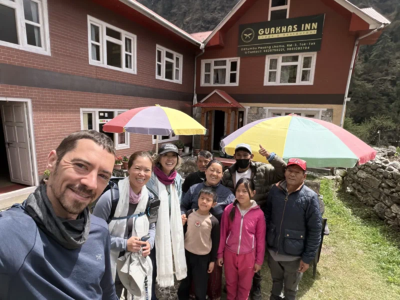
While Nicholas did math at the breakfast table, the porters started hauling our gear into the courtyard and packing it down. After all the days we’d spent at the Gurkha Inn, the family gave us a proper send-off. Scarves, photos, the whole ceremony.
White khata scarves. A real farewell. We’d basically moved in, so this was earned.
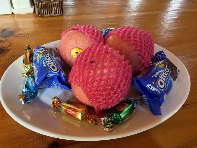
They also handed over a farewell treat plate. I assume the apples were for the horses. The Oreos and the small pile of wrapped candy, however, were clearly meant for me.
Then we geared up and headed out.
The crew, ready to go. Pokin in full mask-and-sunglasses armor. She was not feeling great and the outfit said so.
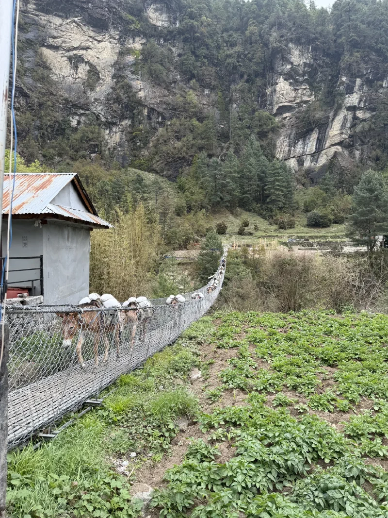
The way out of town crossed one of the big suspension bridges, which meant the usual ritual: stand there and wait while a cargo train of donkeys decides whether or not it’s their turn.
Right of way on these trails is decided by the animals. You wait. They cross. That is the system.
After that it was just trail. Down, then up, then more up. Lukla sits higher than Phakding, so the last stretch back is a climb, not a stroll.
This is the part where I have to bring up the horse situation.
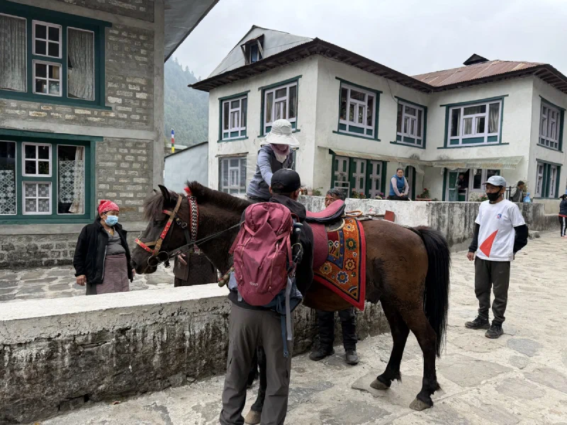
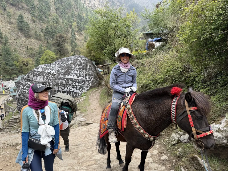
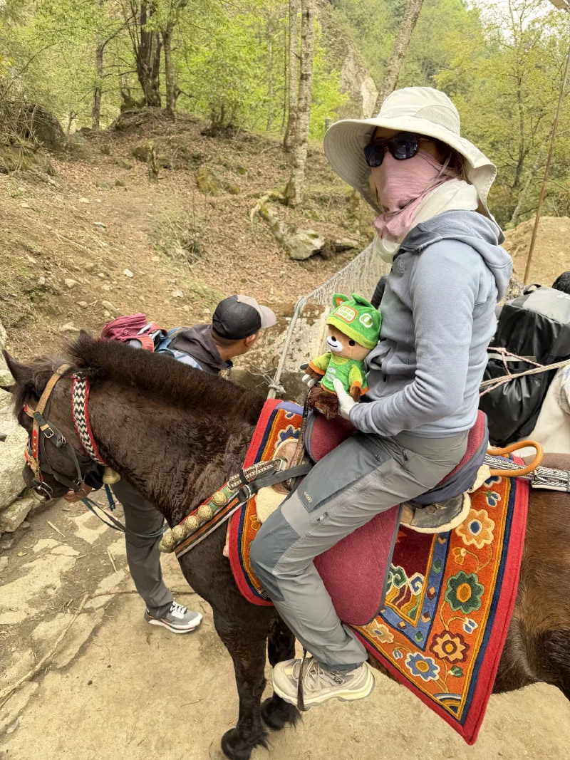
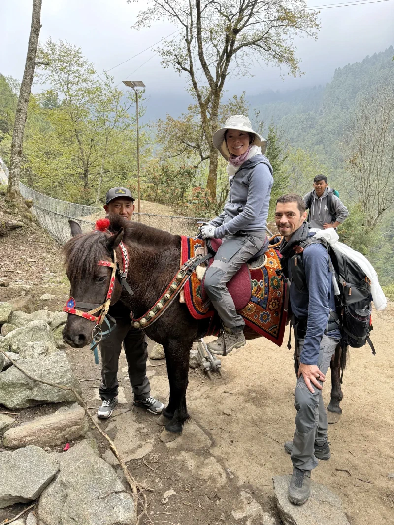
Here is the thing you need to know. This entire trip, every single time a horse came up as an option, Pokin refused. Flatly. She watched Po On ride one back to Tengboche days earlier. Saw it work perfectly. Still said no. She wanted to do the whole thing on her own legs, which is an admirable instinct right up until your legs and your lungs disagree with you.
I never understood this. I make my bud carry me everywhere and it’s fantastic. I have no notes on the system. The system is perfect.
So we’re maybe two hours of solid uphill from Lukla, and Pokin starts coughing in a way that isn’t “I have a cold” so much as “I might fold up on this trail.” Real fits. The kind where you stop walking because you have to.
Nicholas watched it for a bit and told her, flat out, that he was getting a horse. You’d think that would settle it. It did not. Pokin just kept walking, having quietly decided that if she could outwalk the horse, she wouldn’t have to ride it. The horse did not even exist yet and she was already racing it.
So Nicholas went back, found Nilman, negotiated the horse anyway, and then caught up to her on the trail. By this point Pokin had thrown so much energy into outrunning a hypothetical, not-yet-purchased horse that she’d completely wrecked herself. She was now too tired to walk back to where the horse actually was.
So the horse came to her. She lost a race against an animal that hadn’t been hired when the race started. Chestnut, somewhere back in Las Vegas, just felt a great disturbance and has no idea why he’s suddenly so happy.
Nilman found a local, the local found a horse. Negotiations happened in a language that was not ours.
The horse that showed up was big. Not pony big. Intimidatingly, structurally big. His name was Rocky, which felt about right. He looked at the trail ahead like it had personally wasted his time.
Mounting up. This took some doing. The horse did not care either way.
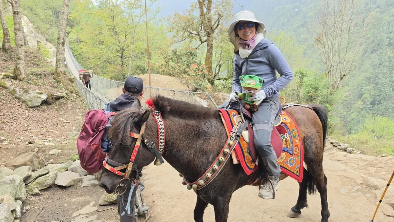
And then something annoying happened. She felt better immediately.
The face of a woman who fought this exact outcome for the entire trip. Note who got to ride up there with her. Obviously I supervised.
You could see the relief from the ground. One minute she’s coughing herself inside out, next minute she’s up on this enormous animal cruising toward Lukla like she’s leading a parade. I rode shotgun for part of it, purely in a supervisory capacity.
Past the mani stones, looking suspiciously cheerful for someone who lost an argument.
The horse hauled her up that mountain like the elevation didn’t exist. The rest of us scuttled along behind on foot, trying to keep pace with a creature that climbs Himalayan trails for a living. We lost.
Lukla, and the Hotel That Was Too Fancy to Feed Us#
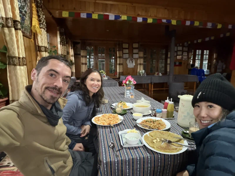
We made it into Lukla without any further drama, which after this trek felt almost suspicious. Checked into our hotel, which was very nice. Too nice, it turned out. The kind of nice where the restaurant is more interested in looking good than feeding you.
So we went next door to a place called the Yak Hotel. Everyone assumed it would be a downgrade. They said the food was excellent, but I’m still not convinced it wasn’t just relief that they’d survived another hike.
Nicholas, Pokin, and Po On at the Yak Hotel. Three people who expected a sad dinner and got the opposite.
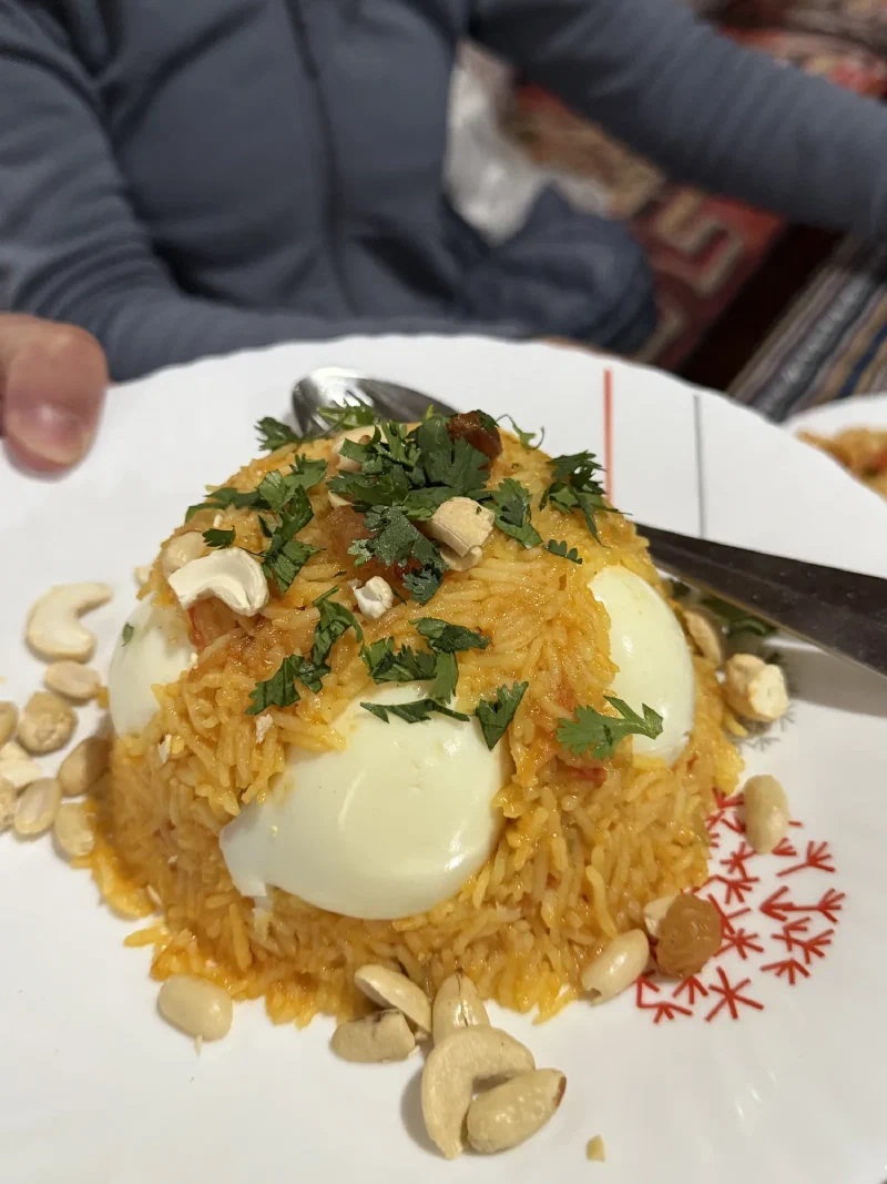
There were noodles, pancakes, a mountain of rice with eggs and cashews stuck in it. I did not partake. None of it was cocoa. None of it was chocolate. I observed, judged, and approved of their enthusiasm from a safe distance.
And that was the day. We made it to Lukla, settled in, and decided to hunker down for the night and wait for Steve and Alice to arrive in the morning.
One more night up here. One more round of goodbyes coming, to the porters, the crew, to D.B., and then the helicopter back to Kathmandu.
The mountain was almost done with us. We were almost done with the mountain. Pokin, for the record, finished the last leg in the saddle, and I will be bringing it up forever.
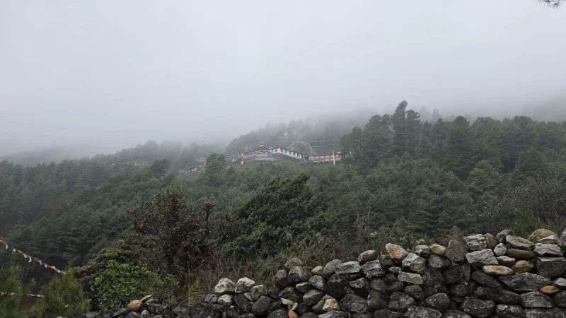
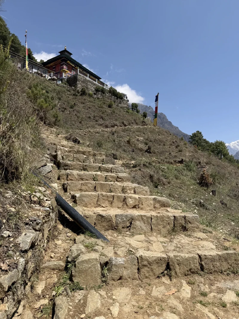
Remember this? A speck of a monastery floating in the mist on a far ridge above the village, a whole valley away. Back when we first spotted it, it was barely a smudge in the fog, the kind of place that looks like it’s deliberately not wanting to be found. Nicholas took one look and decided it was a main quest he absolutely had to complete.
The view from the village. That smudge in the middle is the entire objective. Good luck.
He was still sick, still coughing, and the smart move was to rest. So obviously he went looking for a way up instead. And he reached it, eventually, three-quarters of the way up the hill before the building finally stopped hiding and resolved into something real.
The same monastery, now most of the way up the climb. Much closer. Much more pleased with himself.
But getting there is the whole story, so let’s back up.
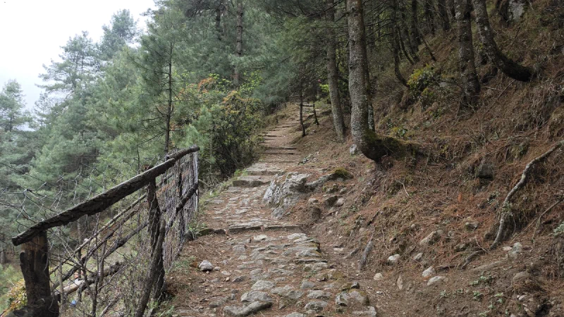
Here’s the problem: there was no marked trail. Just a hillside full of paths that all looked promising and then dead-ended, or split, or wandered off toward someone’s potato field. Nicholas spent the rest days doing reconnaissance. Up one route, back down. Up another, back down. Slightly higher each time, mapping the hill by trial and error like he was clearing fog off a minimap.
One of roughly four hundred paths that looked like the path and was not the path.
Eventually he found one that kept going. Up through the pines, past stone walls and prayer flags, higher than any of the false starts. This was the one.
And then he hit the gate. And the gate won.
The boss that defeated him on the first attempt: a fence. He stood here, looked at it, decided the monastery must be closed, and turned around.
He climbed all that way, found the right path at last, and ran straight into this thing: a few wooden bars laid across the trail. And he stopped. He looked at it, concluded the monastery was closed, and walked back down the mountain.
It’s a cow gate. It is the lowest-effort obstacle a Himalayan hillside can produce. The bars just slide out and lift away. Its entire job is to inconvenience livestock, who are, on average, smarter about it than he was that day. A wall of sticks meant for cows successfully repelled Nicholas like a confused heifer.
He only figured it out later that you can just move the bars. Slid them out, walked through, slid them back, because he’s not an animal. (For the record, I was in the backpack the whole time, judging. Both times.)
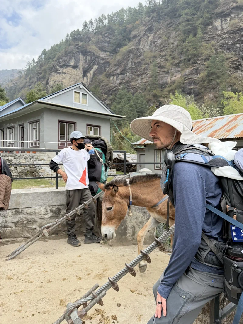
There were ponies working the village, hauling supplies around. The cows, on the other hand, mostly just wandered the trails getting in the way. (More on the cows later.)
And then the steps. The final approach is a staircase of rough stone climbing straight up to the building, because of course the reward for finding the unmarked path is more climbing.
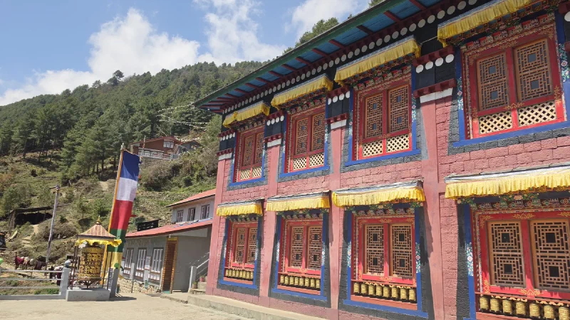
The last push. The monastery, finally, not hiding anymore.Red walls, gold trim, a prayer wheel, the works. Worth the four hundred wrong turns? Nicholas says yes. Nicholas also can’t feel his legs.
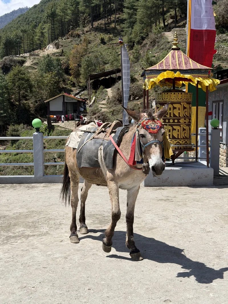
There’s a large, beautifully painted prayer wheel, and directly behind it, a sign for the toilet. The sacred and the practical, sharing a wall. Even monasteries have priorities.
Spin for enlightenment. Facilities to your right.
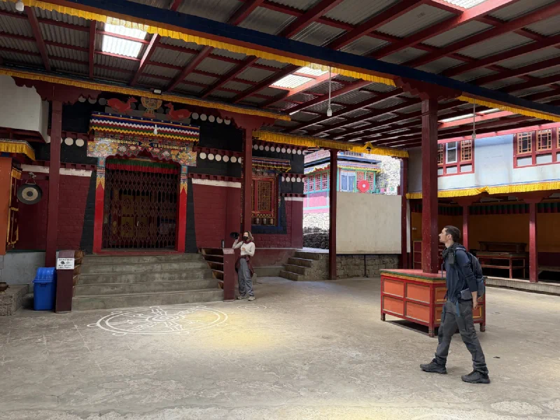
Inside, a covered courtyard with a mandala painted right into the floor, leading toward the prayer hall. I stayed in the bag for this part. You don’t bring a bear out in a working temple. It’s disrespectful, and I have a reputation to maintain.
Nicholas in the courtyard. On his best behavior, which for him means walking slowly and not touching anything.
Young monks were out on the lawn, robes drying on a line, a dog supervising. Regular life, at altitude, with the entire Himalaya as a backyard.
Laundry day at the monastery. The view from their clothesline is better than the view from anywhere I have ever lived.
Pokin and Po On had heard all about the monastery and were, understandably, jealous. So once they started feeling stronger, Nicholas became a guide.
It didn’t happen all at once. Pokin was still weak, so it was a build. A little higher one day. A little higher the next. Until the day they both made it all the way up.
The climb also produced the cow incident. Somewhere on the way up, Po On vanished. Five minutes pass. Nicholas is standing there going where the heck is Po On, and finally trudges back down the trail to find her frozen in place, held hostage by cows. A few of them had claimed the path and she was too scared to push past, with no idea you can simply tell a cow to move. So it stood there. And so did she. Indefinitely. A standoff she was losing.
Nicholas groaned, walked up, went “sha! sha!”, slapped a few rumps, and the cows grudgingly shuffled aside about three steps, exactly enough for Po On to scurry through. Then he made fun of her the entire rest of the way up for getting held captive by cows. Correct response. They’re cows.
The enemy. Roughly the threat level of a parked sofa. Po On was held at this exact checkpoint until Nicholas came back to negotiate her release.They made it. The whole crew at the top. No cows were consulted.
The viewpoint at the top is the payoff, and it does not disappoint. Mountains on one side, the whole forested valley dropping away on the other, and the village they’d been staring up at it from now a cluster of dots far below. From up here, the smudge was looking down on everything else. Role reversal. I respect it.
Nicholas went back up alone that evening, because of course he did. This was now his fifth or sixth lap of the same hill. He sat and listened to the monks chant for a while, and recorded some of the music they made up there.
Afterward, someone mentioned there was a second monastery. Higher up. Secret. And the directions to it were the kind of vague that gets a tourist hopelessly lost on a mountain in the dark.
Rather than wander somewhere he wasn’t supposed to be, Nicholas asked if someone could actually show him. One of the young teenage monks volunteered and led him up the hill to it.
The secret one. Stone lions guarding the door, a lookout platform, and an inside that nobody got to see.
This one was a platform with an outlook, the entrance guarded by a pair of carved stone lions. No monks living there yet. The interior was being rebuilt, so that part stayed off limits, which honestly only made it better.
The payoff was the viewpoint itself. Golden deer flanking a dharma wheel along the parapet, the young monk who’d brought him up there leaning on the wall beside them, and beyond all of it, nothing. The mist had rolled all the way in and swallowed the entire valley. You couldn’t see the mountains, you couldn’t see the village, you couldn’t see anything. Just two golden deer, a guide in maroon robes, and a wall of white.
The lookout. Golden deer, a dharma wheel, a young monk, and a view of absolutely nothing because the fog had eaten the whole valley. Somehow that made it better.
So the main quest, the smudge in the fog he’d stared at from the village and refused to let go of, turned out to have a hidden second stage. A half-finished secret monastery on a mountaintop, reachable only if a teenager decides to take pity on you, with a viewpoint that showed you nothing at all. You don’t find that by resting when you’re sick. You find it by being too stubborn to.
A few more nights in Phakding. The plan: let Pokin and Po On finish recovering before we head down to Lukla, meet back up with Steve and Alice, and catch the helicopter out to Kathmandu.
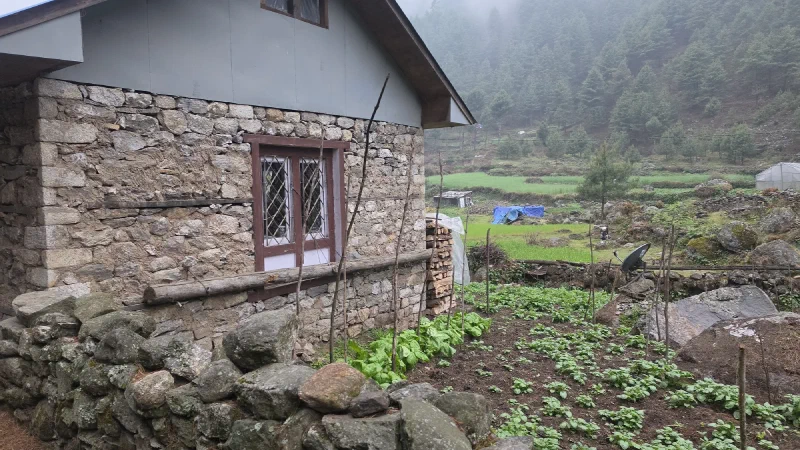
DB picked us a place run by a friend of his, a Sherpa family who own the Gurkha Inn. Big vegetable garden, cozy courtyard, and a mom named Nima Sherpa who cooks every single thing herself. Nicholas declared it the best food of the entire trip, and he said it with the specific reverence of a man who’d been eating dal bhat at altitude for two weeks.
The courtyard. A few tables and a mountain in the background.
We’ll start with the salad, because it was the most dramatic thing that happened to a vegetable all week.
The whole trip, everyone was careful about food. The rule on a trek like this is you don’t eat fresh washed vegetables raw, because the water they’re rinsed in can wreck you. And wrecking your stomach when half the group is already sick is not the move.
So Nima, rightfully proud of her garden, brought out a beautiful salad. Big fresh lettuce leaves. Still wet from washing.
Pokin, Nicholas, and Po On all made eye contact. The silent “uh oh.” You can’t refuse it, that’s rude, and she grew it herself. But eating it raw was a real gamble.
Pokin’s solution was quietly tactical: she ordered a pot of hot water for “tea.” Then, every time Nima turned her back, the three of them dunked their lettuce into the boiling water in their glasses, fished it out, and ate it as fast as possible. Praying it killed whatever needed killing.
Salad front and center. Three adults in this photo are about to blanch their lettuce in a teacup. Nima suspects nothing.
Nobody got sick. The specialty dunked salad was a success, and I’m only telling you about it now because we’re safely off the mountain.
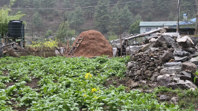
Here’s the thing about the upper mountain: there are basically no vegetables. Everything is hauled up by porter or yak, so the higher you go, the more your diet narrows to rice, potatoes, and whatever survives the trip. Coming back down to a place with an actual garden meant Nima was pulling things out of the ground and putting them on the table the same day.
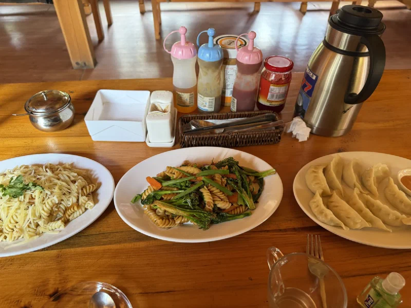
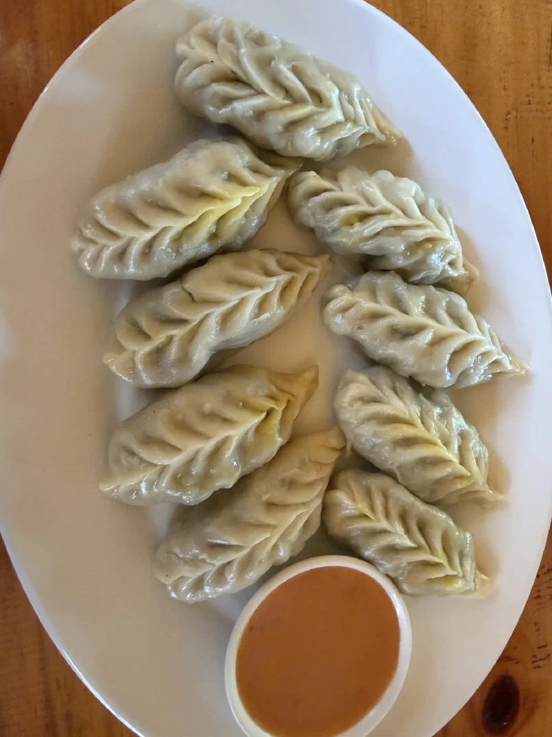
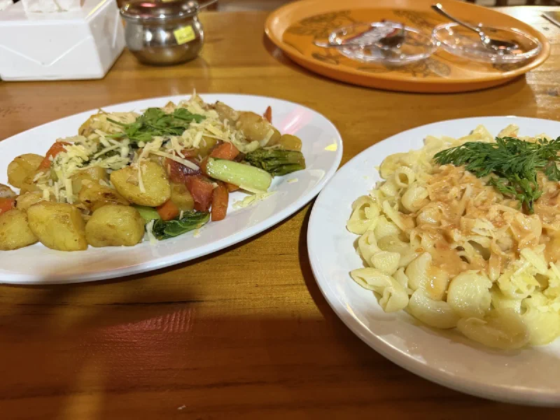
Momos with vegetables, obviously. Pasta with veggies, potatoes done several ways, even homemade fries. The veg fried pasta was the clear winner. We ordered it enough times that Nima probably thought we couldn’t read the rest of the menu.
The veg fried pasta. Our undisputed favorite. We ordered it enough times that I’m fairly sure Nima thought we were broken.
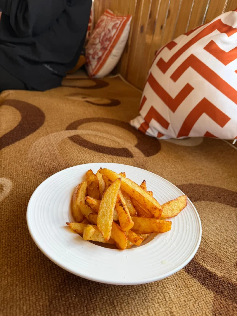
The fries were homemade from the garden potatoes. Po On declared them life-changing and proceeded to order them at every single meal for the rest of our stay. Between her fries and the veg fried pasta, Nima had two standing orders she could set her watch by.
Po On got a crepe. Nicholas had apples in his oatmeal, which is really just Chestnut’s order. Chestnut is a horse. Apples are basically his version of pillow chocolates, and he gets very invested in making sure they show up.
During the downtime, Kerman decided Nicholas needed proper initiation into being a real porter. You may remember Nicholas already borrowed a namlo on the way up to Thukla and carried his own bag for four hours, which apparently earned him an apprenticeship he didn’t ask for.
So Kerman found an old rice bag, cut it into strips, and then produced a sewing needle and thread out of thin air, the way porters seem to produce any tool they need from nowhere, and sewed Nicholas a real, custom namlo by hand.
Kerman sewing. Nicholas watching.
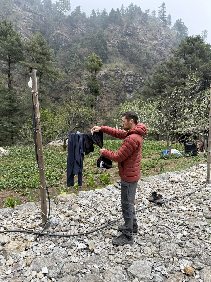
Meanwhile, Nicholas handled the other half of porter life: laundry, by hand, strung up on a line with a whole valley behind him.
This one was ridiculous, and I mean that as the highest compliment a story can earn.
One morning we woke up and Kerman and Nilman were gone. Nima said they were “out doing work.” Fine. Porters often help around the farm on off days to earn their keep, so we figured they were doing chores somewhere.
They were gone a long time.
When they finally came back, they were each hauling a MASSIVE white sack. Easily sixty pounds. Bulging. We assumed they’d done a supply run, hauled up food and goods for the inn.
Nicholas inspecting the haul. Two enormous sacks. We were sure it was supplies. Flour, maybe. Rice. Something that made sense.
Then Nicholas looked inside.
Branches. Just… branches. What looked like plain old pine branches.
“Did you guys go out and pick pine branches?”
“Yes. Way up in the mountains.”
The big reveal. Sixty pounds of foliage. They climbed for hours, used chains and ropes on the steep bits, and carried this back down on their heads.
Turns out DB had called them and sent them on an epic hike straight uphill toward Kongde, a trail steep enough that parts of it need a chain and rope to get up and down. Six hours of climbing just to get to the top. They were gone all day. To pick branches.
For context, Kongde sits up around 4,000 meters on the ridge across the valley, well over a kilometer of vertical above Phakding. That’s not a stroll to the corner store. People take entire acclimatization days just to go up and look at it. The porters did the climb, harvested a small forest, and then came back down the same chains and ropes with sixty pounds strapped to their foreheads. On a day off.
And the branches weren’t pine. They were sage. Specifically the pure high-altitude mountain sage that the monks burn every morning for prayer, and that families burn too. Apparently this stuff is ceremonial grade, the “good stuff,” and it doesn’t grow down where you can just buy it cheap.
Later, while Nicholas was on the phone with DB sorting out logistics, he asked: “Did you make the guys bring back a hundred pounds of branches?”
“Haha, yes,” DB said. “I’ll bring it back to my family and friends to burn for the year. We can truck it back, otherwise it’s very expensive.”
So either DB is running a quiet artisanal sage-harvesting operation, or he just really likes good sage. I cannot tell which. Either way, two men hiked six hours up a chain-and-rope mountain trail to bring back a tree, and that is the most Himalayan thing I witnessed all week.
People have been asking about the astrophotography.
Fair enough. We’ve spent the last several posts talking about Nicholas destroying his body for these shots. Three consecutive nights at extreme altitude. Zero sleep. Getting sick. Sleeping on a literal mountain. All for photos that are still sitting on an SD card in a camera bag in a Himalayan lodge.
We don’t have a computer up here. The Z9 files are massive and there’s no way to properly edit them on a phone. But Nicholas pulled one frame off the camera, opened it on his phone, and did a quick color grade so you can at least see what all the suffering was about.
This is not the final edit. This is a phone preview of a raw file. It’s going to look a little blown out, a little rough around the edges. The real versions will come when we’re home with actual monitors and actual software.
But even rough, it’s something.
First, here’s what the location looks like during the day. This is the Sherpa Memorial at Chukpi Lhara, near Lobuche. Nicholas scouted it during the afternoon hike and immediately started planning the night shoot.
The view from the Sherpa Memorial by day. Pyramidal peak on the left, valley funneling toward the glacier, snow-covered summits all the way across the horizon. Not a bad spot.
And here’s what it looks like at 3 AM.
The Milky Way over the Himalayas. Shot from the Sherpa Memorial. This is a quick phone edit of one frame from the timelapse. The real versions are coming.
The Milky Way. The Galactic Center. Arcing over the entire Himalayan skyline, with the snow on the peaks still faintly visible in the starlight. Thousands of stars, dust lanes, nebular structure. The valley below disappearing into darkness with a single point of light from Dingboche far below.
This is one frame from one night. There are three more nights of timelapses on that SD card.
The full edits are coming when we get home. For now, this preview will have to do.
Rest day in Phakding. Pokin and Po On are recovering. Nicholas is about 40% better but still coughing. Everyone’s supposed to be taking it easy.
So naturally, Nicholas went for a walk.
He came back an hour later and said, “Sumi, this village is a video game.”
He wasn’t wrong.
This is where a quest NPC lives. You find this cabin, talk to the old hermit inside, and he sends you to retrieve something from the bottom of the river. You die three times trying.
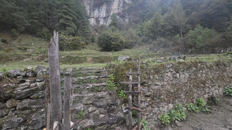
I’ve played a lot of games. Skyrim. The Witcher. Every open-world RPG where you wander into some village and every building looks like it was placed there by a level designer who wanted you to feel something. The stone walls. The handmade wooden fences. The mysterious hut on the cliff that’s definitely hiding a side quest.
Phakding is that village. Except nobody designed it. People just built it this way because that’s how you build things when you’re in a Himalayan river valley with no power tools and a lot of rocks.
Starter area farm. Handmade ladder for +2 Agility. Branch fence crafted from local materials. The cliff in the background definitely has a cave you’re supposed to explore later.
The farm plots have handmade wooden ladders propped against stone walls. The fences are built from branches. Not treated lumber. Not hardware store posts. Actual branches lashed together. It looks exactly like what happens in a game when you visit a village in the first act before you have access to any real materials.
Herbalist’s house. 100%. You knock on this door and an old woman sells you potions. There’s a vegetable garden out front because of course there is.
Then Nicholas found the crafting district.
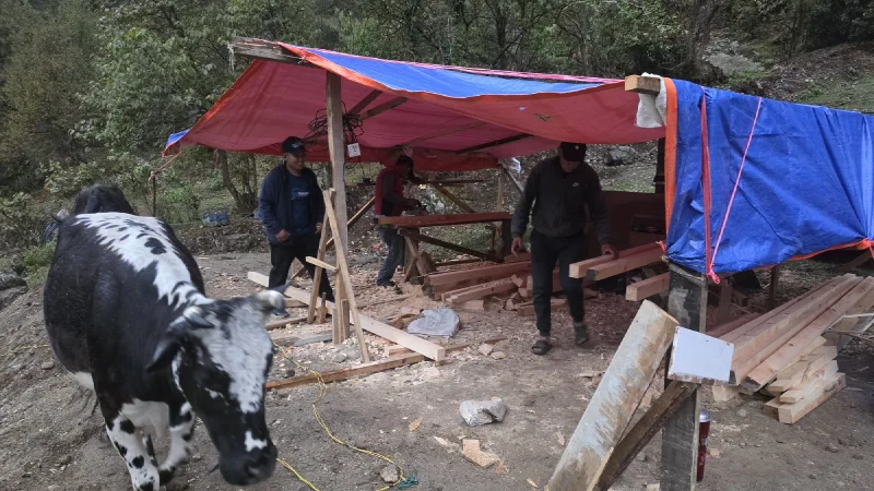
The Lumber Mill. NPCs processing logs into planks. The cow is either a quest marker or part of the ambient wildlife system. Hard to tell.
People were hauling raw logs down from the forest, bringing them to this open-air camp under tarps, and hand-turning them into boards. With hatchets. No table saws. No planers. No power tools of any kind. Just hatchets, hands, and chisels. Then they were building a house with the boards they just made. From trees they just cut. The entire supply chain was visible in one frame.
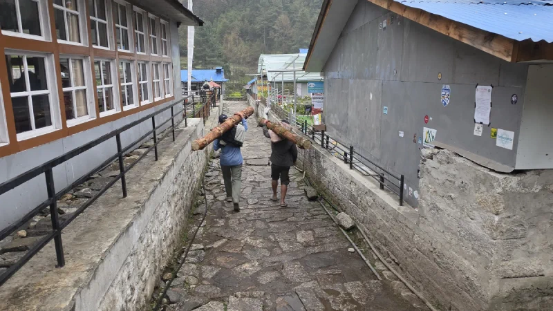
Log delivery. Manual fast travel. These two are carrying full tree trunks through a village alley like it’s a normal Tuesday errand.
And the quarry.
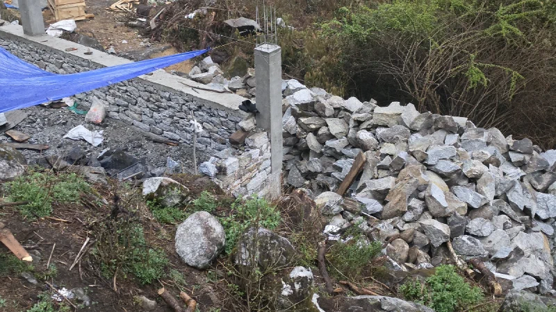
The Stonecutter’s camp. Hauling rocks up from the mountain, breaking them with sledgehammers, stacking them into walls. This is how buildings get built here. No cranes. No forklifts. Just people and hammers.
Someone was hauling boulders up from the riverbed, and another person with a sledgehammer was smashing them into building-sized stones. Then they’d stack those stones into walls by hand. An entire house, built from rocks you broke yourself from bigger rocks. If this were a game, this would be a crafting minigame that reviewers would call “surprisingly satisfying.”
Then Nicholas looked up and spotted these:
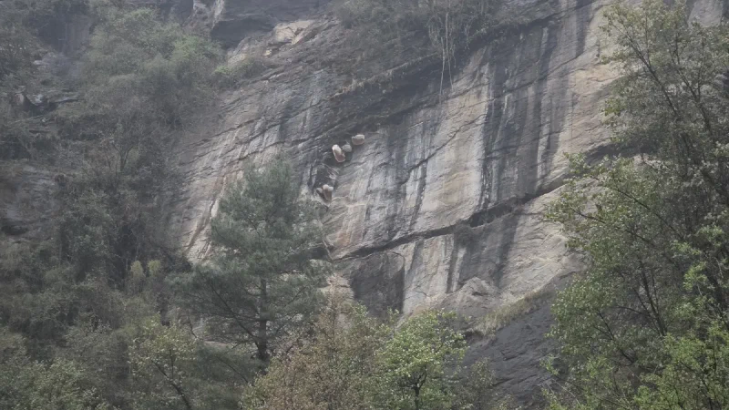
Wild beehives. Hanging from a cliff. In a game, you’d need to climb up there to gather Rare Honey for a cooking quest. In real life, same thing, except the bees are also real and they’re enormous.
Giant wild beehives, clinging to a sheer cliff face. Unreachable without climbing gear or a very questionable decision. In every RPG I’ve ever played, there’s a moment where you see a collectible on a ledge and think, “I can definitely get up there.” This is that ledge. Except the collectible fights back.
And just when you think it can’t get more video game:
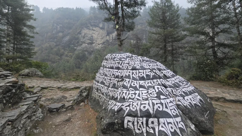
The Runestone. Walk up to it and press A to absorb ancient power. Or just read the Tibetan inscription, which is probably ‘Om Mani Padme Hum,’ which is basically the same thing.
A carved mani stone in a misty forest clearing. Prayer flags draped from the trees. Tibetan script painted in white across the dark rock. If you stumbled onto this in Skyrim, you’d hear a choir start singing and a skill tree would light up. Here it just sits quietly in the fog, which honestly makes it more powerful.
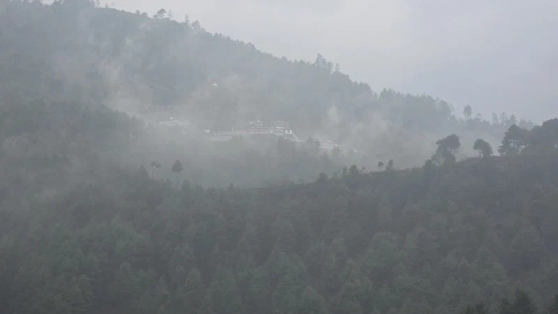
The Monastery. Up in the mist. On a cliff. With no visible way to get there. This is either end-game content or a Crouching Tiger, Hidden Dragon set piece. Either way, you’re not getting up there at Level 1.
A monastery. On a cliff. In the mist. With no discernible path to reach it. In a game, this would be the area you can see from the starting zone but can’t access until you’ve unlocked flying or completed a 40-hour questline. It just sits up there, reminding you that you’re not ready yet.
If you’ve seen a more video game village than Phakding, let me know. I’ve been to 30+ countries. I’ve been to actual medieval towns in Europe. None of them hit like this. This place has handmade ladders, cliff beehives, runestones in the fog, a lumber mill staffed entirely by people with hatchets, and a floating monastery.
Phakding isn’t a rest stop on the EBC trek. It’s a starting zone in the greatest RPG nobody’s made yet.